|
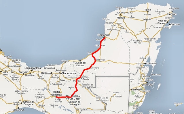
To Campeche
Stairway to Heaven
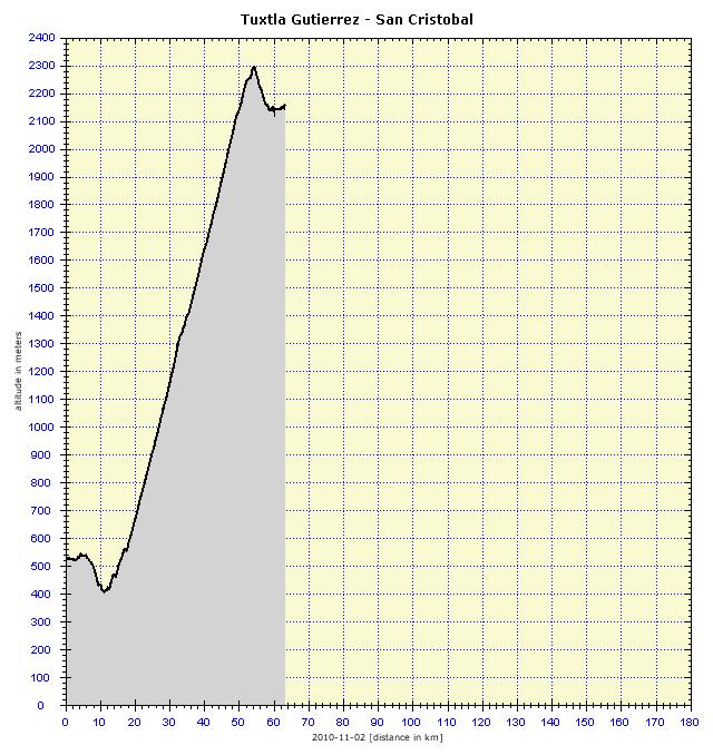
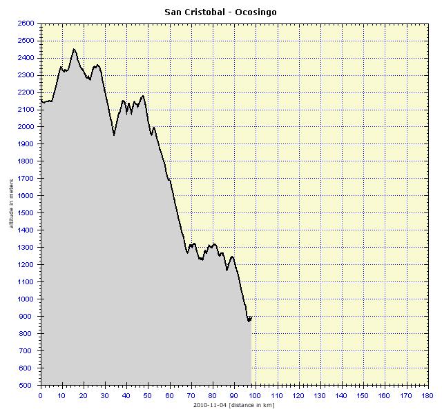
Tuxtla Gutiérrez is located at an altitude of 530 meters, San Cristóbal de las Casas at an altitude of 2,160 meters. But that’s not all – it was first necessary to descend from Tuxtla 100 vertical meters into Chiapa. San Cristóbal is located in a valley between the mountains, so these had to be crossed. Therefore, a vertical distance of 2,000 meters lay ahead, and this was really a lot. I wanted to avoid Cinturón de Miseria (Slum Belt), which is a series of villages and slums surrounding San Cristobal, an area of frequent robberies and assaults. That is why in Chiapa de Corzo I hit the paid highway. Surprisingly, there were no signs prohibiting cycling. I cycled through the toll gate, without asking anybody and nobody said a word to me, so that was that. Along the way, a few police cars passed me, no problem. Well, there was one problem actually, the road was long and steep, its profile reflecting the nearly 1,900 meters that had to be climbed within 45 kilometers. Look at the terrain profile and realize that I drew every point of the steep incline with buckets of my own sweat. And according to the calorie consumption, this stage was the most demanding on the Mexican trip so far – 3,658 kcal.
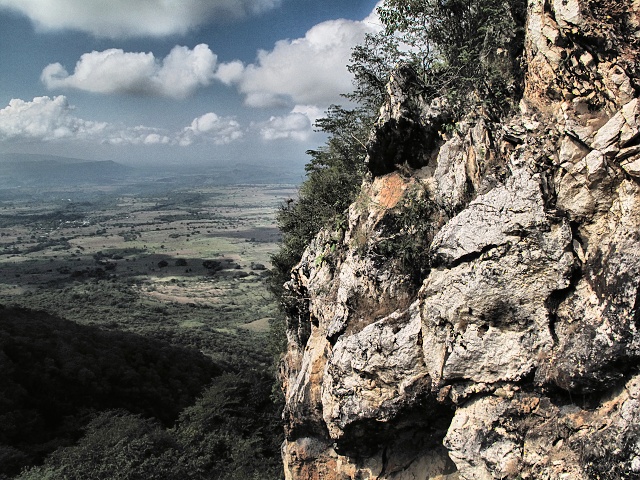
[Near Tuxtla] Climb to San Cristóbal
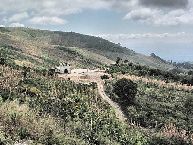
[Near Tuxtla] Simple church in the mountains
Day of the Dead
The main festival is celebrated on November 2. All the preparations were complete, the graves had been cleaned, freshly painted and the paint was already dry. I arrived in the city cemetery in San Cristóbal and it was so crowded that I had a problem getting through the main road of the fairly large cemetery. The whole atmosphere was that of a pleasant picnic. People were sitting in front of tombs or right on top of the graves, stuffing themselves with goodies and drinking publicly (which in Mexico is strictly prohibited and punishable). The musicians were performing to order, everyone was chatting and having a good time. There were many stalls outside the cemetery, flowers and colors were already passé, now it was mainly food and drink, desserts and sweets, and also balloons and various toys for children. There was a traffic jam on the road, various cops everywhere, controlling the chaos pretty inefficiently by blowing on their shrill whistles. This, after all did not take much effort (although it did not help much either).
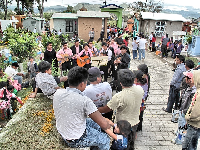
[San Cristobal de las Casas] Merry music being played in the cemetery
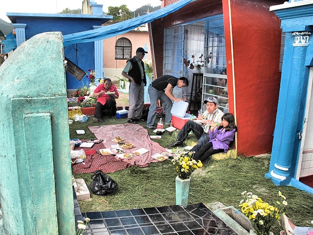
[San Cristobal de las Casas] Definitely no lack of food at the graveside
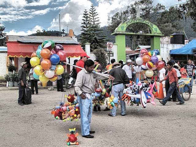
[San Cristobal de las Casas] Business thrives in front of the cemetery
San Cristóbal de las Casas
The city is named after a Dominican monk. Dominicans did really God-fearing work there, protecting the original inhabitants from harm. They were very successful in this, able to effectively and uncompromisingly resist the original Spanish nobility. They actually perform this duty to this day.
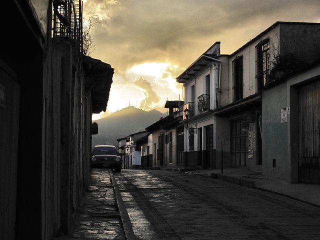
[San Cristobal de las Casas] Lane in the center after the rain
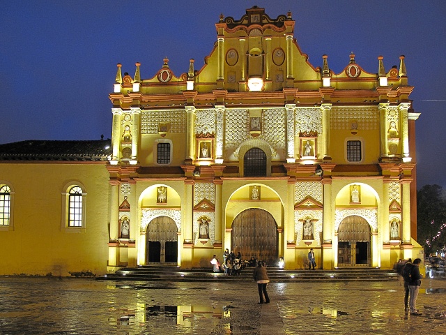
[San Cristobal de las Casas] Cathedral on the Plaza 31 de Marzo
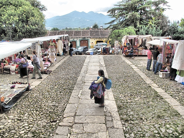
[San Cristobal de las Casas] Saleswoman selling embroidered souvenirs in front of Templo de Santo Domingo
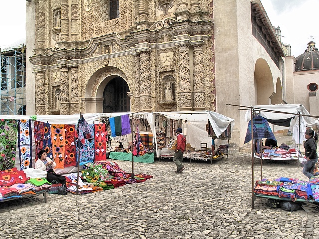
[San Cristobal de las Casas] The area in front of the Templo de Santo Domingo is filled with unsightly peddlers' stalls
However, I did not like the place. There were a lot of tourists, rain every day, the city is defaced with Marxist-Leninist slogans to which I have always been allergic. But the people especially were strange there. Local stall vendors are recruited from the poorest strata and look at the rich and pampered tourists as a necessary evil, without whose money they would have been even worse off. Local women walk about, dressed in traditional costumes, usually carrying children tied to their backs with a blanket, so they are the frequent object of tourist photos. Some tourists are so impertinent that they take photos of the women even while breastfeeding. I do not have the guts for this and do not have to record everything on photos, it is important to experience things, not always to take photos.

[San Cristobal de las Casas] El Arco del Carmen
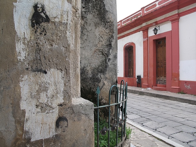
[San Cristobal de las Casas] Cracked wall with paintings in the center
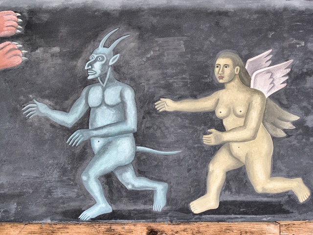
[San Cristobal de las Casas] Detail of the fresco in the cloister of the Faculty of Law
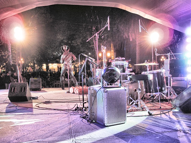
[San Cristobal de las Casas] Bands of different genres were alternating on the square from morning to night during the Multicultural Mexico festival
Tourist Photographers
Regarding this issue: All of you probably know, from your own vacations, the person who looks at everything through a viewfinder. If he/she has not captured it in a photo, he/she has not been there! There are two types—the ambitious photographer equipped with an expensive reflex camera and the pure amateur (usually a woman) toting a cheap compact camera with the motto: “I photograph whatever I see.” These ladies take photos in dark churches without a tripod (where flash photography is prohibited) and do not care if the photo consists only of grainy smudges. I saw a representative of the first kind par excellence in Monte Albán. A participant in a French organized tour, about my age, was running around the archaeological site like a madman. He photographed an artifact, he photographed the explanatory sign, he looked at the map and ran to the next site. He never stopped, never looked around, he basically did not know where he was (sure, he will see it all at home). During the 14-day trip he might take an estimated 6,000 to 8,000 photos. But what will he do with them? How will he organize them, edit them, make enlargements? To whom will he then show the images? Is there anyone willing to look at more than 100 photos in a row, even if they are amazing?
Zapatistas
On New Year's Day 1994, the hitherto unknown EZNL (Zapatista Army of National Liberation), occupied San Cristóbal and several surrounding villages. The Mexican government had to deploy the army. Since then the conflict has still smoldered, there have been hundreds of victims on both sides and no end in sight. For this reason, there was a strong army presence in this area. It was guarding some tourist destinations (caves, archaeological sites) to prevent assaults and robberies.
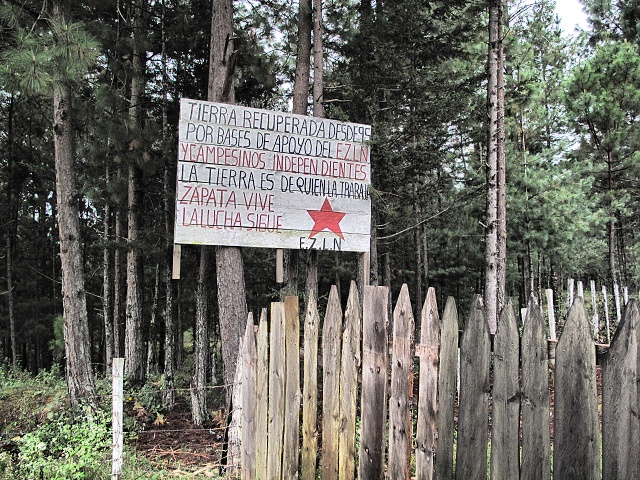
[Near San Cristobal] Statement of the Zapatista Army FZLN on private land near the road
Rain and Cold
Inspired by the smooth road surface from Tuxtla, I expected to ascend from the valley, cross the saddle and then cycle steadily down and soon arrive in Ocosingo. Of course it was not to be. First I had to pedal up to an altitude of almost 2,5OO meters and then I travelled through the mountains in a back-to-front style. So during the descent ride, I climbed up almost 1,200 meters. The morning was pretty cold, I wore a windstopper fleece jacket and leggings. I cycled up into the clouds, it was drizzling from them and the temperature declined even more. Then it really started to rain. I put on my whole waterproof outfit—jacket and trousers. A razor-sharp wind joined the party and I was shivering with cold. I was quite glad it was not just a descent and that I could warm myself up during the frequent uphills. I could not speed up on the downhills, the surface was wet and slippery, some sections were horribly broken and everywhere there were plenty of speed bumps. The speed bumps were not marked or highlighted. I cycle without glasses in the rain and often saw them at the last moment. In addition, I was passing through the poor settlements of Cinturón de Miseria, which were not a cheerful sight, but perfectly matched the dreary weather. However, people in this area responded as usual, cheered, waved, gladly responded to my greeting. To put it simply, a man traveling on a bike is not a tourist, he is a poor man comparable to them. Indeed, he does not have enough money to travel by car or even by bus.
The situation changed only 10 kilometers before Ocosingo, I took off the waterproof outfit. In the town I went to a car wash (water-barrel style, no mechanization), where the boy washed the bike all around with detergent, with a brush hand-scrubbed the wheels, frame, chain and bag, all for a reasonable 10 pesos. The wheels were all shiny. In the morning I would have to lubricate them.
Never-ending Hills
In the morning, there was a classic climb up from the valley to the saddle. Obviously I had this scheduled instead of my morning exercise, which I was consistently neglecting. Added to this, there was heavy rain, so by the time I reached the military control I was already totally sweaty in the rain suit, but the soldiers were even more tightly wrapped up inside their tent canvas. The jacket had already reached retirement age and the sleeves got wet fairly quickly. So far, the trousers were holding out. The road was often very bad, unfilled and sunken asphalt, places without a reinforced surface (apparently washed away by water), sudden potholes, some even 30 centimeters deep. The contest for the most horrible piece of road was clearly won by “Taxi's Ditch”, a speed bump (topes, i.e. one bump followed by vibradores –a set of small bumps, quite unsuitable for a bike), after which there was a pool of water, about a meter wide and nearly half a meter deep. The bike made a cracking sound but survived without damage. The Federal government apparently does not allocate enough money to road repairs, in order to show the Zapatistas who the boss is—with the result that I had to dodge the potholes there.
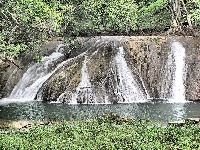
[Near Ocosingo] Waterfalls on the Jataté River
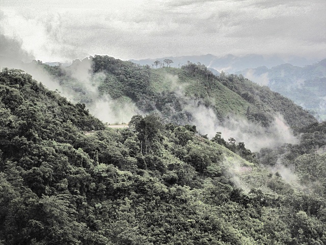
[Near Agua Azul] Finally the rain stopped and the hills could puff away
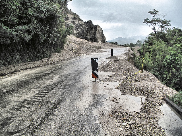
[Near Agua Azul] Roads were often in poor condition, apparently a gift of the Federal government to the Zapatistas
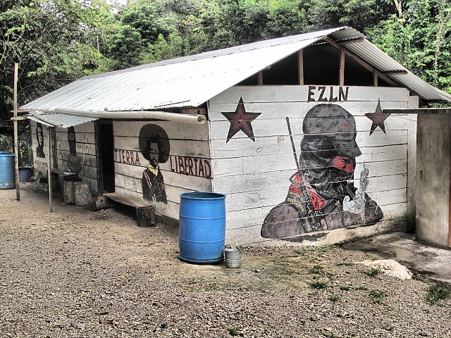
[Agua Azul] The Zapatistas collect contributions for passage through the village to the waterfalls
Before I reached the bypass to the waterfalls, I experienced two events on the main road. A small boy, aged about nine years, first waved at me, then picked up a stone to throw at me. So I gestured a gun with my hand, pointing the index finger at him and shouting "bang-bang!" So he quickly threw away the stone. A few kilometers later, an adult male was standing in the road in front of me, gesturing with his hands for me to stop. Perhaps he wanted my money. Sure, bastard! I hunched up, held down my helmeted head and started pedaling hard and straight towards him. The guy lost his nerve, jumped to the edge of the road and I passed by safely. Also cars from the opposite direction drove towards me twice, but this was rather for fun, to see me jump into the ditch. I did not give them the pleasure. Apparently, the Zapatistas in this region had indoctrinated people with hate. Here were some of the villages which had formally declared independence from the Federal government. There was a large wooden sign with this statement at the entrance to the village. The villages on the roads to tourist attractions (Agua Azul, Misol-Ha) collect fees for passage, which is to support the Zapatistas. They even give you a receipt.
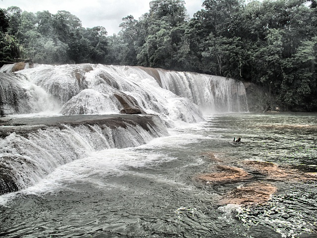
[Agua Azul] Cascades on the Shumula River – the main divide
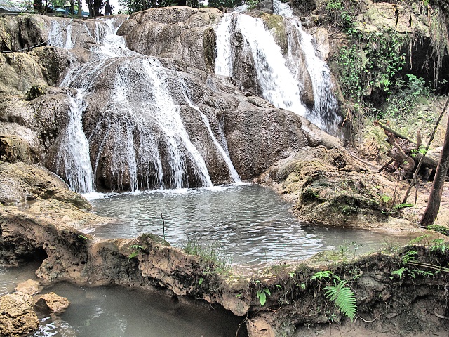
[Agua Azul] Cascade on the Shumula River - one of the side cascades
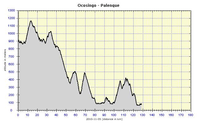
It was clear to me that the well-known waterfalls would still be in the mountains. But then I finally expected flat land. At the waterfalls, I assigned a boy to guard my bike, giving him 5 pesos. I spent an hour there, saw everything that was to be seen. Palenque was 65 kilometers away and I had a little over three hours left before dusk. I thought I would descend from the hills and it would be easy going on flat land. Palenque is situated at an altitude of 80 meters, I was at 550 meters and so this seemed logical. The reality was again different. A 20-kilometer descent to an altitude of 100 meters, and then began a steep climb up to 400 meters. I fought like a lion, to cover as much distance as possible before darkness fell. The road led mostly through the forest, so visibility was bad, especially on the descents. Towards the end, I noticed that the wheel brakes were losing efficiency. I finally arrived in Palenque in total darkness just before 6 p.m. I regretted most of all that I had passed Misol-Ha waterfalls, which are only 1.5 kilometers off the road. Due to the late hour, I had to skip them. I found a cheap, fairly good hotel, where I washed the dirty bags in the shower. The bike did not fit into the bathroom, so I washed it thoroughly with a rag. The brake blocks were already pretty worn out and so I replaced them on the front as well as the rear brakes. Finally, I oiled everything and the bike was ready for further service.
Palenque
The local region receives the highest rainfall in the whole of Mexico and it definitely lived up to its reputation on my visit. Rain in the evening during my arrival, rain until 10 a.m., almost a cloudburst the following day of my departure. So I put on my waterproof clothes and went by colectivo to the ruins (they are about 7 kilometers from the town, the colectivo cost 10 pesos.) The rain decreased considerably and eventually stopped. Mayan buildings are impressive in size, quantity and architecture. And only the bare walls remain, which were originally covered with many colorful frescoes (on site are replicas of the frescoes, the originals can be seen in the local museum or the Museum of Anthropology in Mexico City). The succulent, wet and verdant jungle mercilessly encroaches on all those structures. The most significant finding was the excavation of the tomb of the ruler, Pakal, which is located in the Temple of Inscriptions. The tomb had been open to visitors for 50 years, but because of the moisture they brought into it, was no longer accessible. The local museum has its replica with a lot of informative material. The tomb was covered with a tombstone with a fresco of Pakal entering into heaven (or becoming a god). For those of you who have read Däniken, this is the famous drawing of a man in a “spacecraft” with flames blazing beneath the seat, impressive. I liked the site. I went through the large area twice and really enjoyed it.
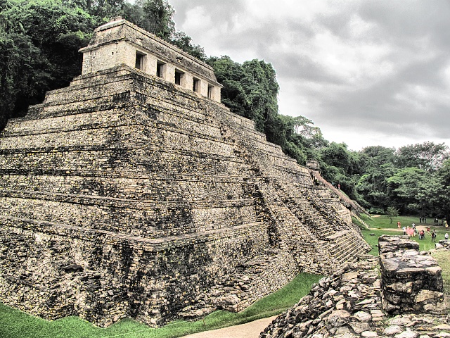
[Palenque] Templo de las Inscripciones (Temple of Inscriptions) - probably the most important building, in which Pakal's tomb was discovered
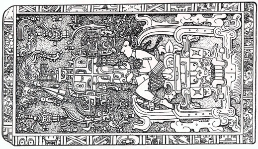
[Palenque] Tombstone of Pakal
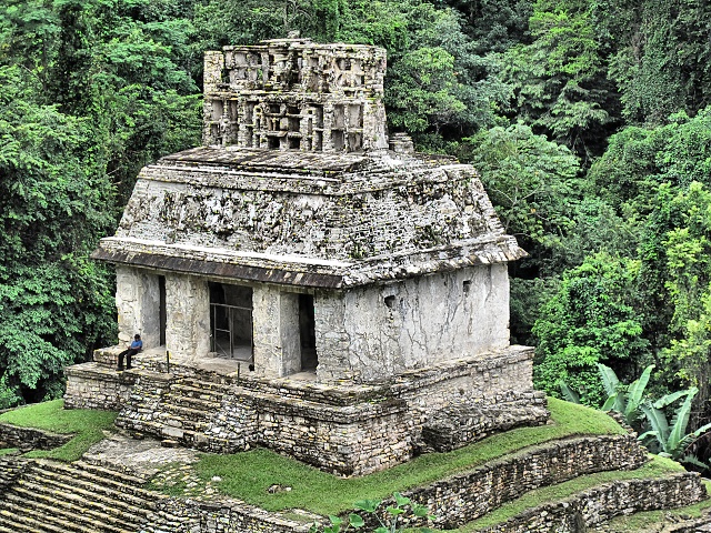
[Palenque] Temple XX from Grupo de las Cruces (Group of Crosses)
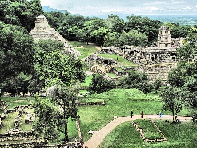
[Palenque] On the left, Templo de las Inscripciones, on the right, El Palacio with a distinctive tower, used for astronomical purposes
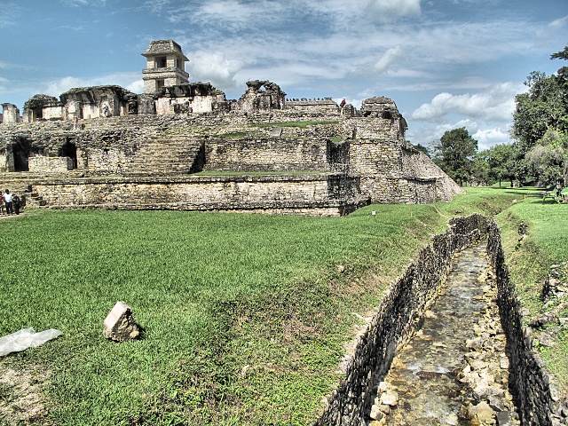
[Palenque] El Palacio and aqueduct, which is partially covered
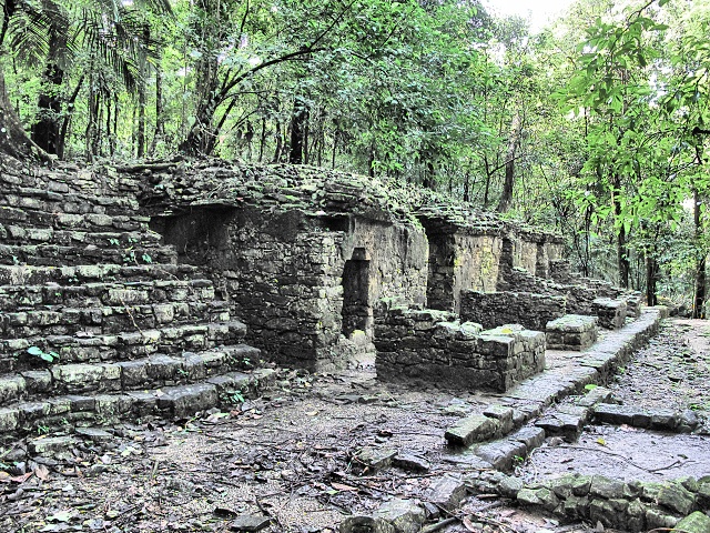
[Palenque] One of the palaces in the Grupo de los Murcielagos was slowly being encroached on by the surrounding jungle
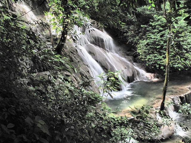
[Palenque] One of the waterfalls in Baòo de la Reina (Queen’s Bath), a series of pools and small waterfalls
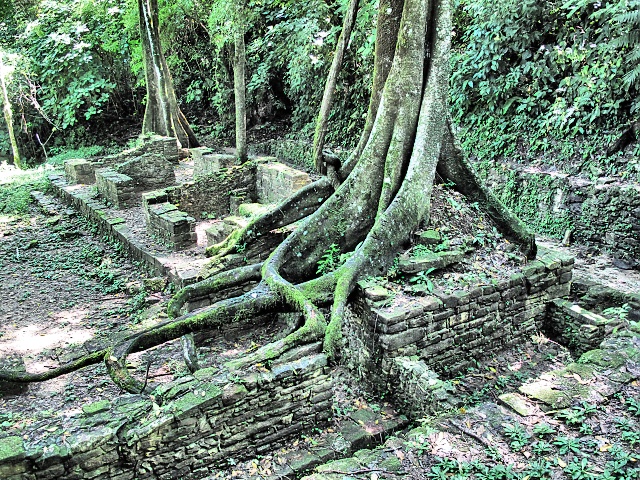
[Palenque] Where left in peace, Nature clearly wins
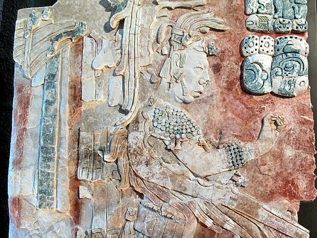
[Palenque] Museo de Sitio - here one gets an idea of the original colors of the frescoes, although over the centuries the red and blue have faded
Misol-Ha
On the return journey, five young Frenchwomen got into the colectivo and negotiated with the driver to take them to the Misol-Ha waterfalls, which is only 20 kilometers from Palenque. I sensed an opportunity, came to an agreement with them and went along as well. The waterfall is impressive, but the best thing is that the path leads beneath the waterfall into a cave from where you can observe its force. That is good, not so good is the fact that you can not get into the cave without getting completely soaked to the bone. Even so, the water spray was swirling into the cave, the humidity was close on 100 percent. I did not dare to take any photos in the “epicenter of moisture”, it would probably have done no good to the camera. Well, it was great. I first had on civvies, then when I realized what was happening, I put on the rain suit. The French chicks decided on swimsuits, but the cold chased them away fairly quickly, shouting and screaming.
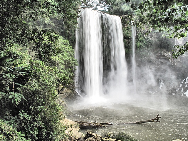
[Misol-Ha] 35-meter waterfall
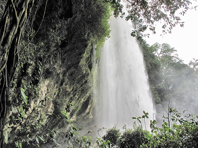
[Misol-Ha] The trail leads to the cave under the waterfall; the water's power is amazing and a complete soaking cannot be avoided
Proper Flat Land
The morning departure from Palenque in a torrential downpour was still on a twisting road, but when I turned at Catzajá, the expected plain appeared. It was pretty boring after those beautiful hills but, on the other hand, a physical relief. Although it was a Sunday, there were many trucks and because the road was lacking a verge, the vehicles drove quite close together. It bothered me because the road was straight, no car was in sight from the opposite direction, yet the trucks did not show any effort to at least minimally swerve towards the middle of the road to drive around me. I started to watch the situation and I had to fight for my space. When I saw a truck in the mirror and no car coming from the opposite direction, I moved into my lane about one meter from the edge. It was clear to the driver that he could not overtake me without turning the steering wheel, so he drove closer to the middle of the road and at that moment I pulled over to the side of the road and thus gained at least a meter of distance between us.
Not to shirk too much, I covered a little over 170 kilometers on that one day, mainly to reach some accommodation. The road led on to a raised embankment, around me were streams, ponds, wet meadows. All the property belonged to private people, it was fenced off. Exits from the road only led to ranches whose gates were locked. Of course, I could still sleep in the tent somewhere, but it would be risky. So I rather kept asking the taxi drivers about the nearest hotel and the result was the 170 kilometers. By the way, the hotel was very overpriced (350 pesos). It benefited from a privileged location, as the next one was 45 kilometers away. And as very often happens to me, also here I was told: “Leave the bike in the courtyard.” Despite this, I always take the bike into the room.
Wet Land
The local area was water-logged. Around the roads were wetlands, lakes, streams and rivers. Cattle and horses grazed up to their knees in water, and apparently liked their water diet. Living in such a damp climate is probably not pleasant, some ranches had more than half of their land flooded. In season there must be swarms of mosquitoes, but there were no insects at that time, only lots of butterflies and dragonflies. There were also a huge number of birds, especially pelicans and herons, and other species which I did not recognize.
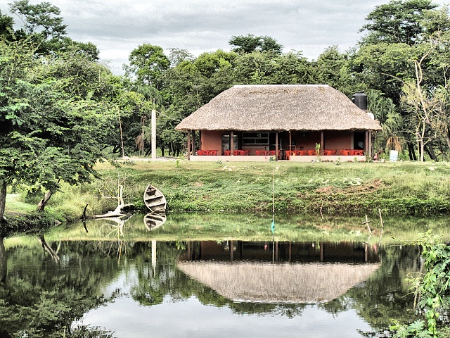
[Nuevo Pital] Totally unusual structure at the lake beside the road
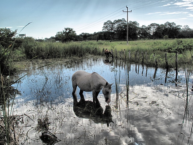
[Dieciocho 9 de Marzo] Horses and cattle graze in the water and it seems as if the water diet tastes good
I wanted to reach Champoton on the ocean shore, and I had two options, both roughly of the same length. Either on the main road to Escárcega (local regional center) and then inland. Or along the winding local roads to Sabancuy and then to follow the main road along the ocean. Although I was concerned about the possible wind along the coast, the shortest route to the sea attracted me. Well, we landlubbers have a liking for the sea, let alone the open ocean
A Man Drowned in the Marsh
I cycled through small settlements, seeing, like many times before, children assembled in the schoolyards before the start of classes, listening to the Headmaster's speech and concluding with the Mexican anthem. I had to respond to dozens of greetings and wave to all sides (it is really an uplifting feeling, I understand now how priests feel when blessing the crowds). Then the extensive marshes began, overgrown with white flowers and water lilies. I nearly fell off my bike in shock when I saw a corpse dressed in a T-shirt and shorts floating in the water. I stopped and turned back. The corpse turned out to be a young man, swimming with snorkel and goggles catching fish by hand. Subsequently I saw dozens of these fishermen, who proudly showed me their catches. The fish were quite small, but they must have tasted delicious.
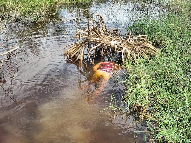
[Near Chekbul] The 'drowned' man who scared me, fishing by hand with goggles and snorkel
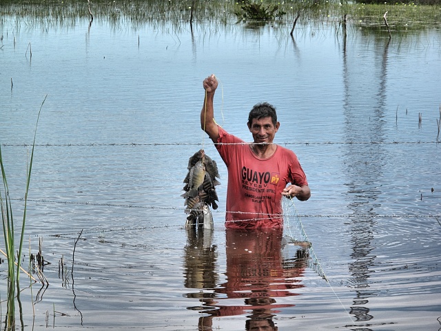
[Near Chekbul] A fisherman boasts with his catch
A good road with a wide verge leads beside the ocean. I did not have to watch out for traffic and could cycle as I liked. Besides lots of birds, there was nothing interesting about the ocean. The access to the coast was mostly on private land and fenced off. There were occasional clusters of villas of people who had bought land with access to the sea (a few of them were definitely Americans). The water seemed quite dirty to me, the river flowing into the sea taking with it dark brown water from the extensive wetlands. This was not my idea of the Caribbean, even though the palm trees and white sands were there too.
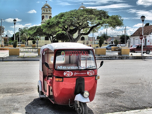
[Sabancuy] The town center is on the shore of Laguna de Terminos, a system of bridges leads to the 2-km distant ocean
Spanish Lesson in the Bakery
In Champotón, I found accommodation on the outskirts, about 1 kilometer from the center, as the hotel in the center was being repaired. But I did not miss anything. I saw the center and there was nothing worth mentioning. I went to the bakery to buy bread (rather, buns) for breakfast. It was getting dark. I greeted: Buenas tardes (good afternoon). The friendly young salesman corrected me, saying that it was already time for Buenas noches (good night). I thanked him for the lesson. At that moment, a typical Mexican with a distinctive mustache arrived and greeted: Buenas tardes. The vendor and I looked at each other and both of us burst out laughing uncontrollably. The newcomer was startled by this, quickly put some bread on a tray, paid, and left. The salesman was educated. He asked where I was from, I replied automatically: "Czechoslovakia" (Bohemia and Slovakia are not known to many people there) and he asked whether I was from the Czech Republic or Slovakia because the country had already split a long time ago. He knew about Prague, although he had never been there, and he knew about Czech football legends (Pavel Nedvìd probably remained the most famous, it was interesting that no one knew Petr Èech). We talked about my trip and I gave him a card with the address of my website. It was a pleasant encounter.
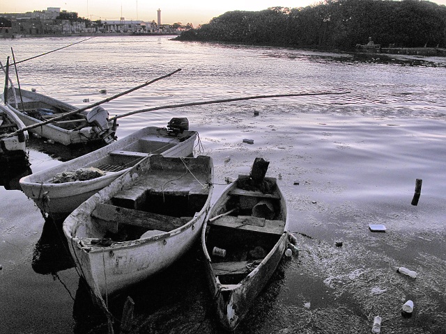
[Champton] Fishing boats on the Champton River at dusk
Campeche
Campeche was just a little over 60 kilometers away. Firstly, an uninteresting plain with a wide verge, where it was perhaps possible to cycle even half asleep. This then changed into a paid road. I chose the Libre road, which at least promised a slightly interesting route along the coast. The seaside town of Seybaplaya was totally under repair without any signs, so I asked the locals for directions. They all sent me to the paid highway, as the unpaid was allegedly terribly hilly. Sweethearts, you have no idea what hills are about, I thought. Here they were of the pleasant variety, bends, downhill at times. I even had to shift to the middle gear. Just idyllic.
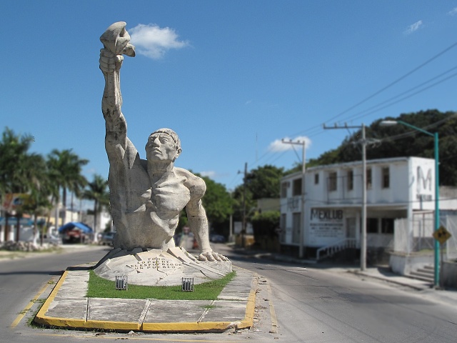
[Campeche] The entrance to the city is guarded by this monster
I found accommodation in the Monkey Hostel on the square, solely because of the unique view from the main lounge of the square and cathedral opposite. I took my sweaty and already really stinky clothes to the laundry. The historical center is too small for the two days I had planned to spend there. Therefore, for the next day I arranged transport to the Edzna archaeological site 60 kilometers away, which is one of the biggest attractions in the State of Campeche. Travel agencies provide transportation back and forth, the actual tour lasts for two hours. They wanted 400 pesos, the guidebook stated 180, so I refused. They thought about it, searched through their papers, and then gave me a price of 200 pesos.
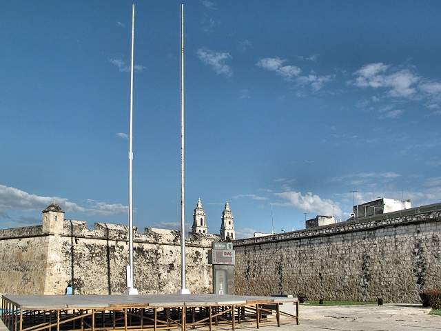
[Campeche] Walls and fortifications protected the town from pirates; originally the sea was just beyond the walls, now it is about 100 meters further away
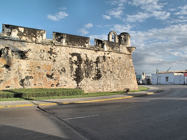
[Campeche] Baluarte de Santa Rosa - fortification surrounds the historical center, separating it from the otherwise uninteresting rest of the city
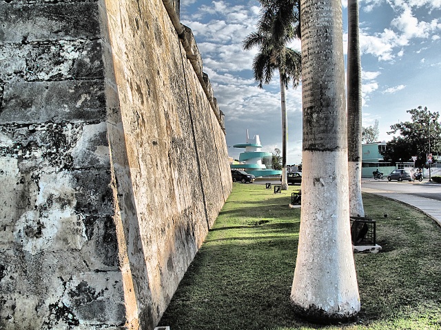
[Campeche] Contrast of ancient walls and extraordinarily ugly modern fountain in the background
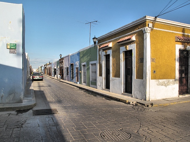
[Campeche] A typical lane, there are also multi-story buildings and an occasional church tower in the center
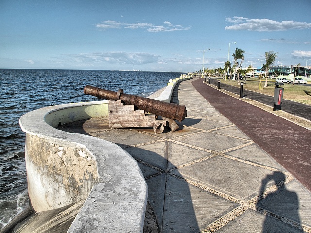
[Campeche] A cycle path on the malecón - promenade
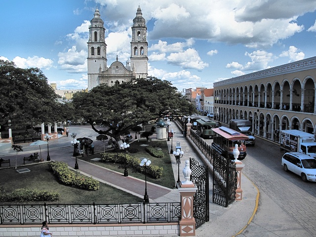
[Campeche] Cathedral seen from the hostel window
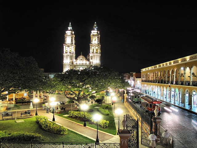
[Campeche] Cathedral at night
Edzna
At 9 a.m. I was picked up at the hostel by the agency's car and, with one American couple, taken to Edzna in an hour. The number of tourists could be counted on one hand. It seemed to be the norm, as there was not a single souvenir salesman in the large archaeological site, unlike in the more popular sites, where they constantly press their junk on to tourists. Two hours were just right, the tour operators had calculated it well. In the unpleasant heat, I managed to climb up to all the structures, frighten away several fattened iguana and, in particular, look at the impressive buildings. Too bad that their outer decorations had not endured, the stuccos having disappeared over time. Only in a few places was the initially predominant red color still visible. The most significant structure is the Edificio de los Cinco Pisos (a five-story building). This is an unusual combination of a pyramid and residential building, consisting of, if I remember correctly, 27 residential rooms. In season, the “show of sound and light" is performed during which the five-story building is impressively illuminated. I saw photos and it must be amazing. In any case, Edzna is worth a visit, and if you ever wander there, take a look at it.
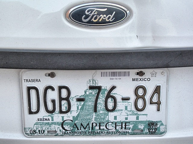
[Campeche] Edzná is so significant to the State of Campeche that it appears in the background of the license plates
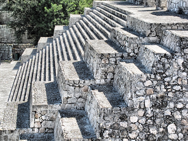
[Edzna] Mayans were really good at Geometry
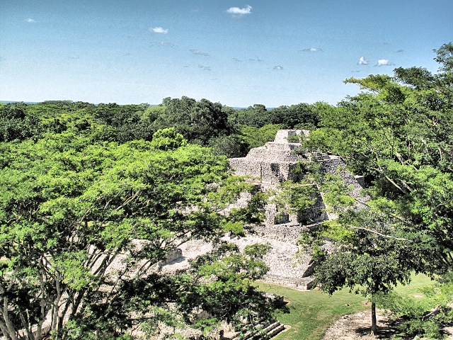
[Edzna] Some of the buildings are hidden by the vegetation
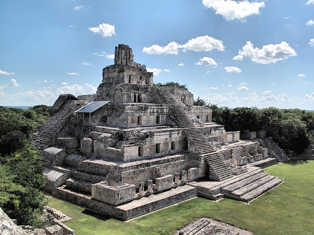
[Edzna] Edificio de los Cinco Pisos - a very unusual combination of a pyramid and residential building, of course with a temple at the very top
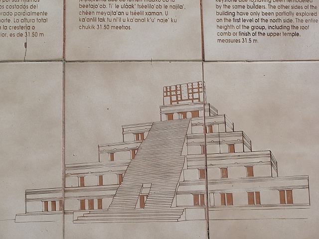
[Edzna] This is what Edificio de los Cinco Pisos (building of five floors) looks like
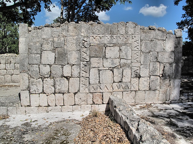
[Edzna] Patio Puuc – decoration in Puuc style
Next Steps
My return flight was scheduled for 14 days later. It was about 400 kilometers to Cancún. I would be there in three days. But I wanted to roam some more in the Yucatán and see several small Mayan monuments that are mostly neglected by tourists. I would zigzag there a little and, if there was any time left, I could swim in the waters of the Gulf of Mexico.


|


