Nothing compares to the simple pleasure of a bike ride. J.F.Kennedy
Search this website
East Coast
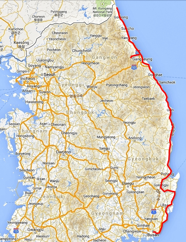
Busan, Gijang, Jeongja, Bonggil, Bulguksa, Gyeongju, Yangdong, Pohang, Wolpo, Wolsong, Samcheok, Jeongdongjin, Gangneung, Sogeumgang Valley, Sokcho, Hwajinpo, Myeongho, Hwajinpo, Sokcho
To the North, to the North
I decided to explore the East coast, where a new long cycling path from Busan all the way to the northern border was being built and was planned to open in 2015. At the time I was there, it was still being built. So I chose the roads with four-digit numbering, i.e. small local roads with less traffic expected.
On that occasion, I did not use the Metro but left Busan by bike. I headed to Songjeong, where a well-known Buddhist temple is located. The road was undulating when my front derailleur stopped working due to a frayed loose wire. I was really surprised as I'd changed it for a new one before the trip. I made a temporary repair, but knew I would have to fix it properly soon by installing a new one. Although I had one in reserve, I did not dare to replace it. I first wanted to buy another spare – just in case.
Haedong Yonggung Temple
The temple on the hill overlooking the sea is no replica, but completely authentic. I got caught up in its atmosphere! I simply enjoyed being there, which was the first time on visiting a Korean site. Entry was free but donation boxes were situated all around. Due to the value of the Korean currency, there were no jingling coins but only crisp notes. The Buddhists are quite handy at charging fees. Around the temple were fountains with bowls into which one could try to throw coins. It was not easy, but even the coins falling outside the bowls belonged to the temple and people seemed to enjoy this activity. At the pagoda dedicated to Safe Travel, I relaxed and threw some coins in the bowl, hoping it would bring some luck to even such a skeptic as I. I could have spent half a day there, but got going after two hours in order to proceed on my trip.
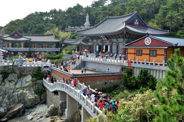
Haedong Yonggung Temple: Buddhist monastery
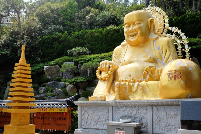
Haedong Yonggung Temple: The Buddha seems content
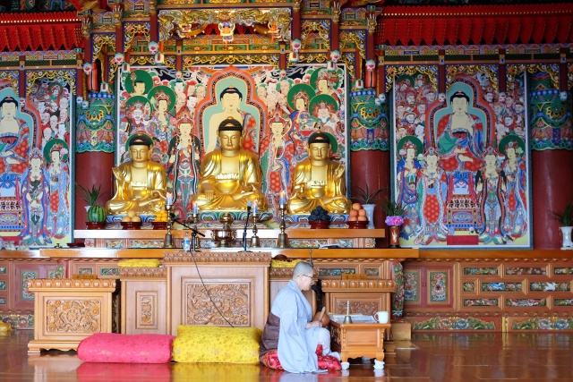
Haedong Yonggung Temple: Ceremony in the temple
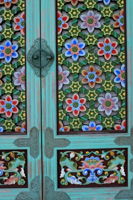
Haedong Yonggung Temple: Details on window shutter
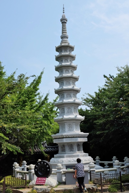
Haedong Yonggung Temple: Pagoda dedicated to safe travel – here I donated a few coins
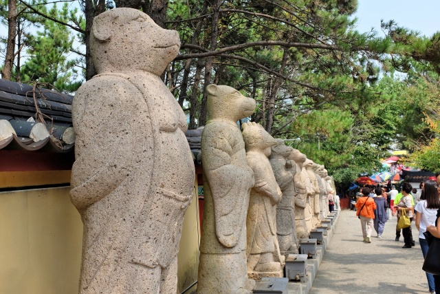
Haedong Yonggung Temple: Animals from the Chinese horoscope – I am a pig – statue on the left
Mandu – Great Lunch
Clouds of steam were coming from stalls along the road in Gijang. These stalls were producing meatball dumplings, which are cooked in steam. Just watching the operation of the steam cookers was fascinating! Filled steam pans were moved from one cooker to the next, in the correct method of cooking dumplings. Plenty of customers were waiting at the stalls and I quickly became one of them. I ate one portion on the spot and took a second one away. I also combined my six well-learned phrases in a way to express my maximum satisfaction. They understood me and seemed pleased.
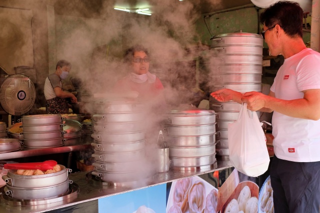
Gijang: Making and selling wickedly tasty meat dumplings
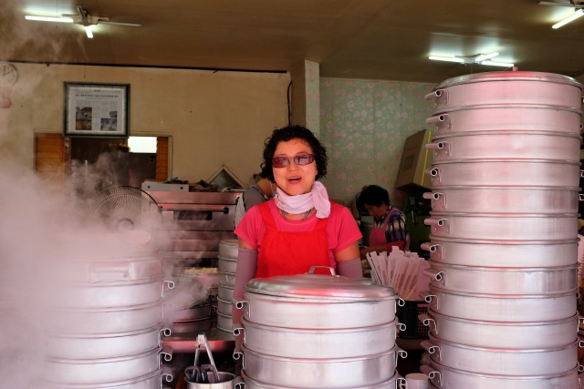
Gijang: I had one portion on the spot and the second one to take away for breakfast. The saleswoman was pleased that I found it tasty.
From a four-digit road, I changed to a two-digit road: Road 31. However, as the number was written on a white background, it was not considered a main road. It went along the seashore. I saw several nice beaches, the nicest of them was Jinha. However, I had no time to enjoy the scenery, the road was busy and without a side lane, so instead I gazed into the rear-view mirrors. Finally after Jinha I found an easy bike path along the river bank, following a sign to the 12 km distant city, which was on my way to Ulsan. I happily took this path and could relax again for a while. However, I was very soon disappointed. After just 4 km, the path suddenly ended at the river. On the other bank (that is, if I swam over) there was no sign of it continuing. They appeared to have built this path as a whole, with everything, including all the signs, without any consideration of the people who might be confused by it.
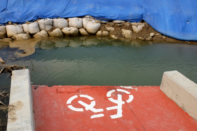
Near Jinha: After 4 km, the bike path led me straight into the river
I got out of there, thanks to the GPS and cycled on to Road 14 (sign with a blue background), which was comparable to a motorway with a safety fence in the middle, dense traffic and a half-meter wide verge. Bicycles were not forbidden, so I cycled on it all the way to Ulsan, a notably large city. It was getting late, so I searched for an open park to sleep over in. As I was not very successful and it was starting to rain, I ended up in the second available motel. I was rejected at the first one, as the owner told me that she did not accept any Englishmen — which was an unusual experience in the otherwise welcoming South Korea. The motel was located near a huge market, where I bought something to eat. I paid attention to where I was walking so as not to get lost, but apparently not sufficiently. After sunset, I lost all my orientation points and was lost for about 20 minutes. I cursed myself for not having taken my GPS with me.
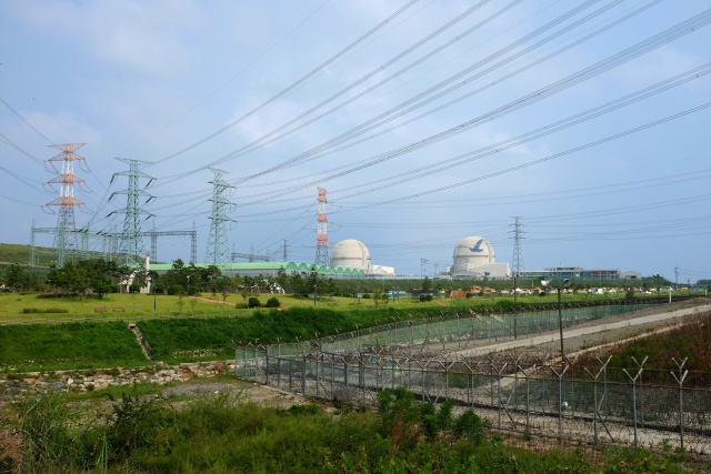
Kori: Nuclear power plant
Large Korean cities are not very cyclist-friendly. At first sight it all looks great – paths are divided into pedestrian and cycling sections. However, they are not really usable, because drivers have the tendency to park on these, tradesmen line up their goods on them and even dog kennels with live dogs can be seen on them. In addition, the paths are paved with a distinct groove in the middle where the bike wheel easily gets stuck and one quickly loses control when changing direction. This is why I cycled in the streets in Ulsan and only used the paths when going uphill on the quite frequent hills.
After leaving the city, Road 31, which I continued to follow, turned into a highway and I could take it easy again as I was cycling on the old original road, dedicated more or less to cyclists. On its 12-km length, only about three cars passed me. The road climbed up a hill, but very slightly, through a beautiful forest. From that road, I then cycled on a bike path which took me through rice fields all the way to the famous Jeongia Coast Beach. I did not enjoy the beach very much, as there was plenty of trash everywhere. The beach promenade was lined with dozens of restaurants with large aquariums filled with fish and crabs waiting for their destiny on someone's plate.
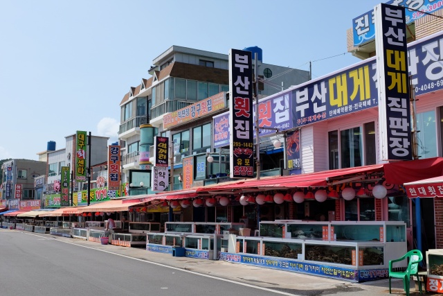
Jeongja: The restaurant offering fresh seafood had still not opened before lunch. The fish were awaiting their fate in the aquarium.
I reached the small town of Nae-ri quite easily. One could see that there was an old nuclear power plant right on the outskirts of the town. The road to it was lined with activists protesting against it, consisting mainly of old women who had nothing to do at home anymore, so they decided to do some good. They seemed tired in the middle of the day. I took out my camera, shouted in Czech "Viva atomic energy!" and at least received an fighting answer in the form of lifted right arms.
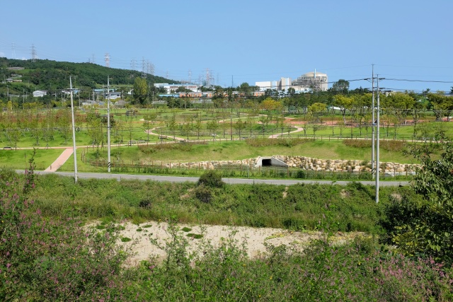
Naa: Wolseong nuclear power plant
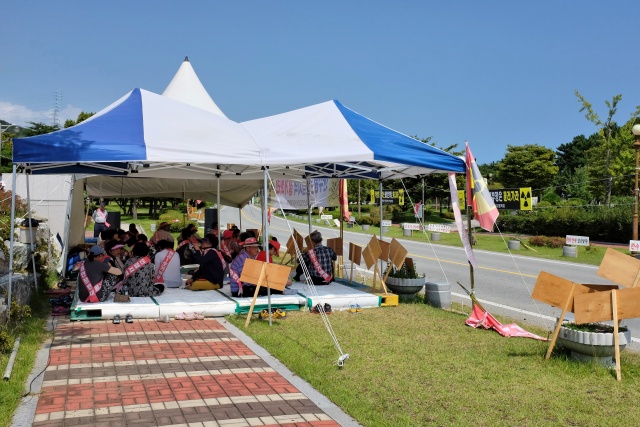
Naa: Camp of protesters against the Wolsegong nuclear power plant
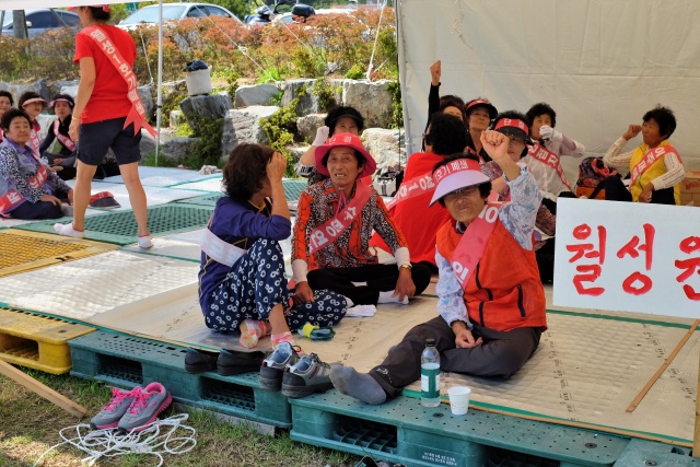
Naa: Protesters against the Wolseong nuclear power plant were a bit lazy in the morning. However, by taking photos, I at least forced them to raise their clenched fists slightly
First Real Tunnel
I had already passed through many tunnels, yet all of them had originally been built for rail traffic, and rebuilt into cycling and pedestrian paths. Just before Bonggil, I reached my first 2.5-km long car tunnel. I entered it, with both front white and rear red lights attached to my helmet. With a bicycle lane only about 40 cm wide, I did not feel that I had enough space, especially when side reflectors also took up some of this space. The opposite direction was divided by pillars in the middle of the tunnel, which consequently prevented cars from overtaking me properly. I could feel them, especially the bigger ones, unpleasantly close. Cycling with full concentration without making any mistakes was the key. To name some positives, the tunnel was well-lit, ventilated and equipped with two security stopping places, where I could stop to take a photo.
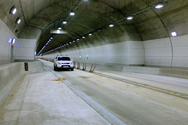
Bonggil: 2.5 km long tunnel with no space for cyclists, except these emergency parking bays
The tunnel spat me out right at the seaside, where I knew a top tourist attraction was located – the Underwater Tomb of King Munmu. Yet there is nothing to see there, the tomb is under water in a cleft on a rocky island located about 200 meters from the shore. It is also the only grave where the deceased requested to be buried underwater. The two ruins of the Gameunsa Temple site with two preserved pagodas were more attractive.
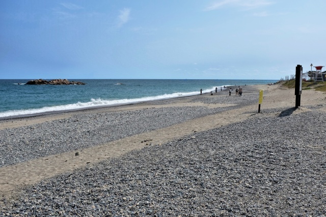
Bonggil: Underwater tomb of great King Munmu is near the small rocky island on the left
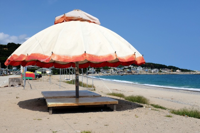
Bonggil: This beach didn't exactly appear to be a first class holiday destination
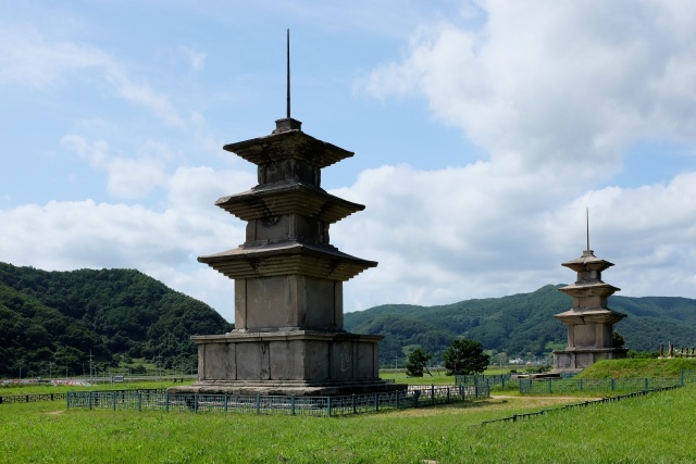
Bonggil: Only two pagodas from the Gameunsa Temple have been preserved
Hanging Out with Chinese Comrades
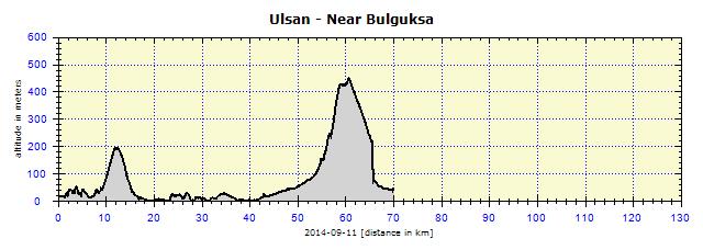
I could have continued on an easy road through the valley to Gyeongju, instead I took the mountain road leading to Bulguksa Temple. The ascent was terribly steep and, although I used the lowest gear, I sweated through all my clothes, every single thread. Even then, and I really hate admitting it, I had to push the bike for about 100 meters! Just before reaching the top, at a crossroads, I met a group of 12 Chinese cyclists who were cycling with half loads. They carried panniers with clothes and food, but no tents or sleeping bags. They stuck to a strict itinerary, with accommodation pre-reserved. No wandering, which I enjoy doing so much.
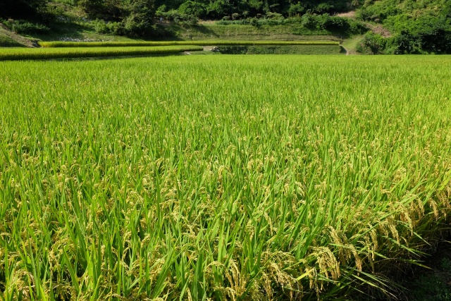
Near Jugam: Lush green of ripening rice fields – a characteristic feature of Korean landscape
They were very welcoming, but English was not their strong point. Then their leader arrived, who could speak a little more English. I asked them about travelling through China and how safe it was. They said that south of the Yangtze River is completely O.K., as well as the north-eastern parts, close to the Korean border. They described China as a totally outstanding country with amazing people. They strongly advised that in China I needed to lock my panniers on the bike and never, and they really stressed this, never to leave the bike and the things on it unattended. They claimed it would all be gone within five minutes. Really 'amazing' people living in China!
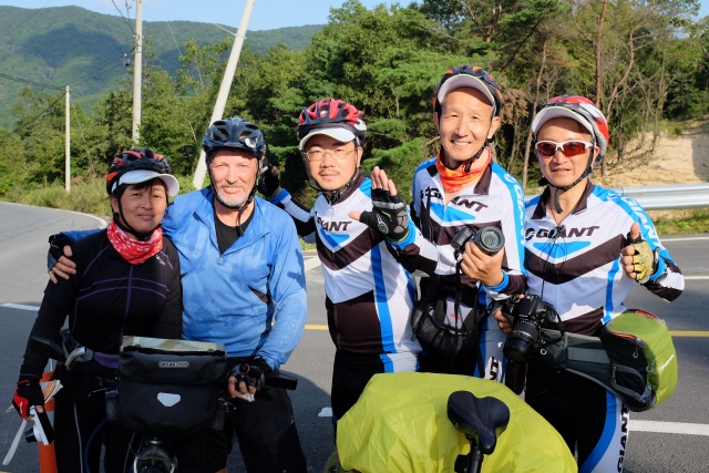
2 km before the summit climb on Seokguram: Souvenir photo with a group of Chinese cyclists – second from the right is my contemporary, born xx years ago, the same year as I.
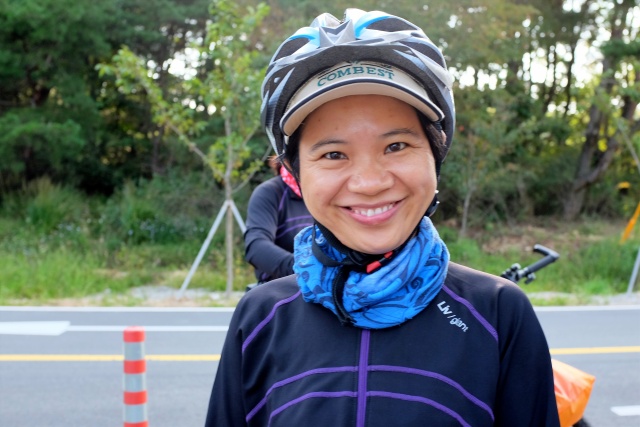
2 km before the summit climb on Seokguram: The smiling eyes of a Chinese cyclist saying farewell
Bulguksa Temple
I arrived on the other side of the hill and a series of spectacular doglegs took me to the gates of Bulguksa Temple. This is one of the most valued Korean sites, located in a dense forest on a hillside above the city of the same name. At the time of my visit, it was rather defaced by a metal wall built around the newly renovated pagoda right in the main courtyard.
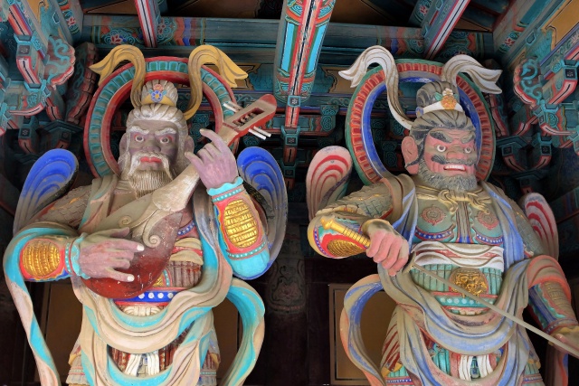
Bulguksa: Custodians at the entrance
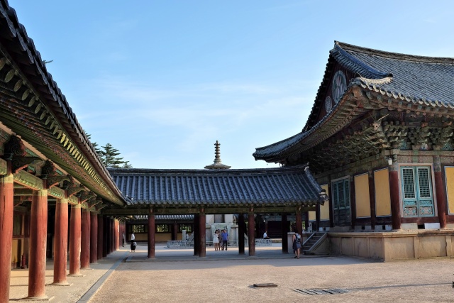
Bulguksa: Courtyard of Buddhist temple
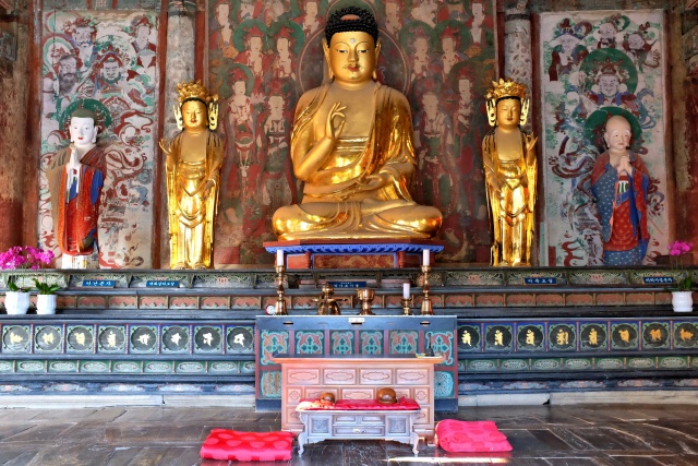
Bulguksa: Altar in one of the temples
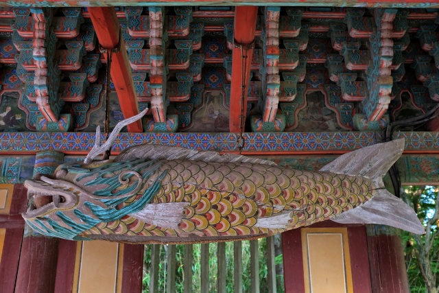
Bulguksa: Wooden fish
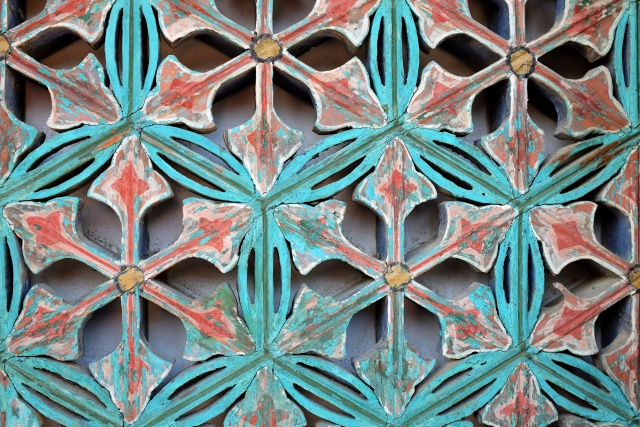
Bulguksa: Details of a window shutter
I left the temple at dusk and reached Road 7, a very busy road filled with many trucks. It was getting darker. I did not feel very safe, so searched for a place to pitch my tent. With rice fields all around it was not easy – they were very wet. I came upon a motel next to the road, so I immediately went in, pleased to have left that dangerous road behind me.
Gyeongju National Park
Gyeongju is a city containing the most historical sites, as it had been the residence of the King of the Silla dynasty for several centuries. However, after the sudden loss of the dominance of the dynasty, the metropolis became a rather insignificant city. Only recently has the city become a tourist destination due to the preserved sites. The city and surroundings have been declared a Historical National Park. Korea has 21 such parks: 16 in the mountains, 4 on the coast and this 1 historical site. Around Bomunho Lake, located 3 km from the city, many expensive hotels have been built, with tourist facilities . However, I did go there to see it, I found accommodation in the city in the Han Jin Hostel.
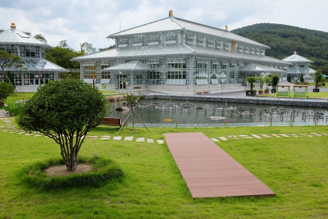
Gyeongju: Botanical garden
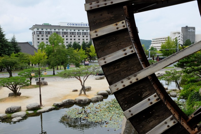
Gyeongju: Park with water wheel at Bomunho Lake
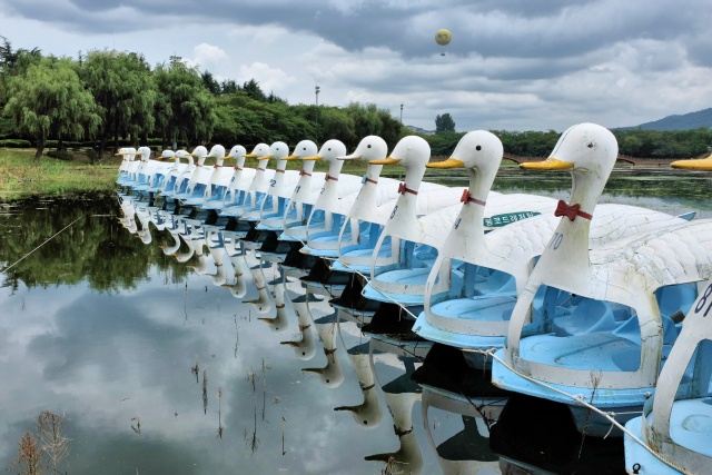
Gyeongju: Classic swan pedal boats on the lake
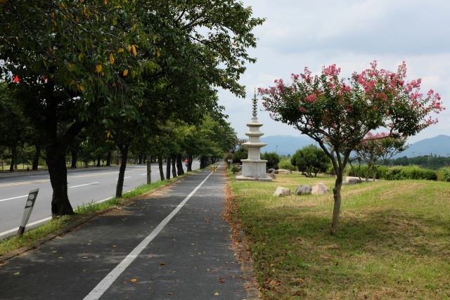
Gyeongju: Bike path from the lake to the city center
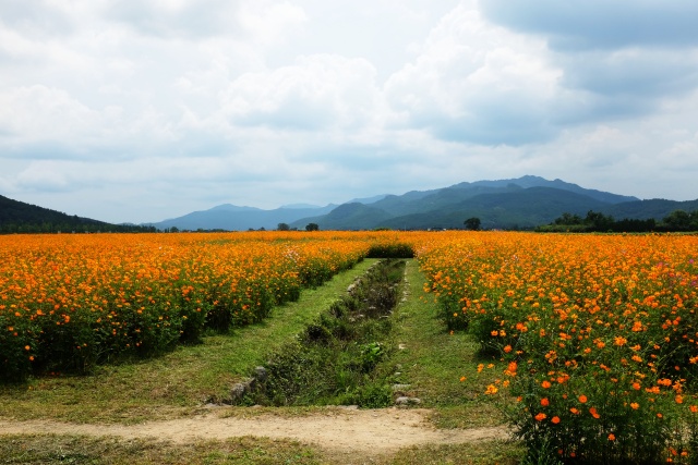
Gyeongju: Summer was not yet over
Kwon Clint, owner of the hostel, was a very warm person with great English. He had lived in the USA for many years, where he had been sent to work on the technology of black and white TV screens. Accommodation was simple and cheap (a single room with bathroom for 440 CZK, or $22) with fantastic service. Kwon told me about the immediate and wider surroundings of the city, suggested what could be reached on foot and where I should use the bicycle. He explained where the market and supermarket were located. He told me about the forthcoming city events. Simply, he gave me all the information I needed.
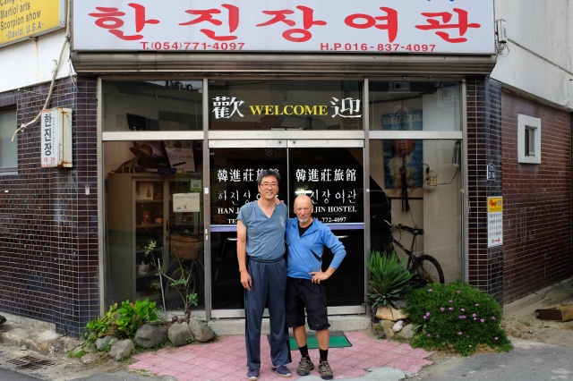
Gyeongju: Kwon Clint – hostel owner – is a bit taller than I
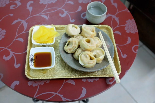
Gyeongju: I had my favorite filled dumplings in the marketplace
I put on my 'civilian' clothes, ate my favorite meat dumplings at the market and headed off to admire the sights of the immediate neighborhood. The most famous are the tombs of the Imperial family, which are spread all over the city, with their greatest density in Tumuli Park almost in the city center. To demonstrate their size: Bonghwangdae Tomb (in the park over the road) is 22 meters high with a circumference of 250 meters. The tomb itself is a massive wooden cabin with a thick layer of soil on top of it, forming a significant hillock. In time, the wooden cabin fell apart and the soil perfectly completed the burial of the bodies. The only tomb of this type in Korea, which has been restored and is open to the public, is Chonmachong Tomb. Photography was not allowed in the interior of the tomb. However I did not notice the sign forbidding it until walking out and then it was too late. I decided not to delete the photo I had already taken. I am very thorough about following these rules and restrictions, but I failed that time. It was an unintentional exception, I promise.
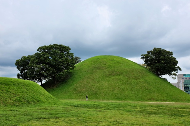
Gyeongju: Ponghwangdae mound is almost in the city center
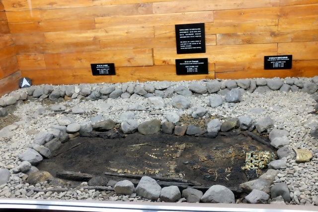
Gyeongju: Chonmachong is the only mound in Korea with access to its interior
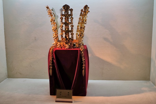
Gyeongju: The golden royal crown found in Chonmachong mound
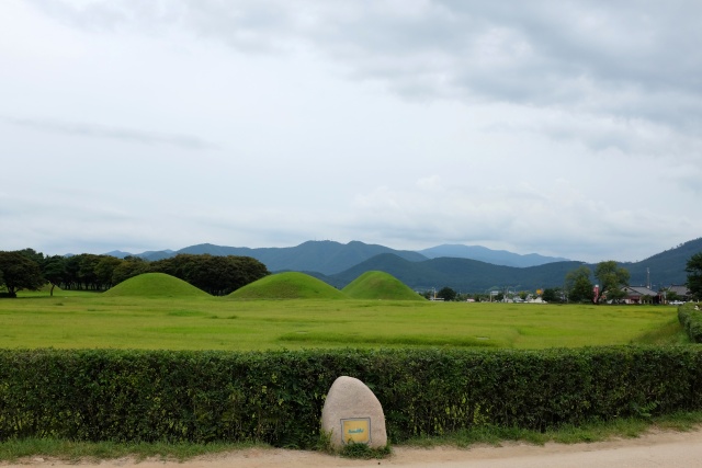
Gyeongju: Mounds everywhere one looks
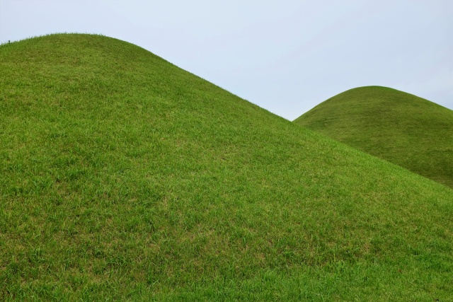
Gyeongju: The mounds have appealing shapes – freely associated with this...
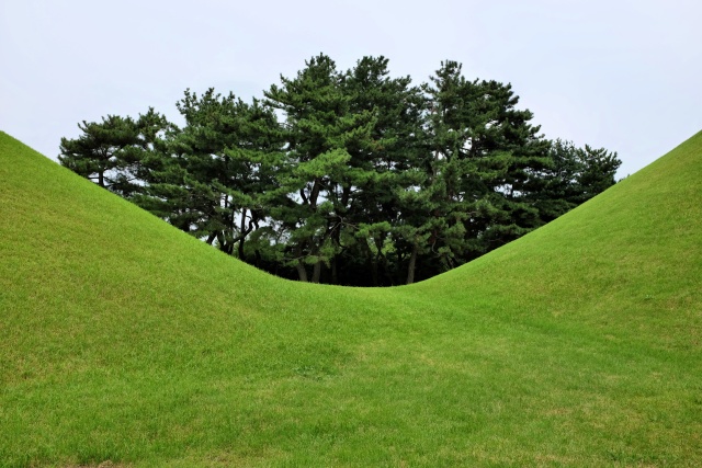
Gyeongju: ...or that
Everything is nice and close in Gyeongju. Wolseong, dominated by the Cheomseongdae Observatory, is situated not far from the tombs. At first sight, it is not a conspicuous structure at all, reminding one of a Leyden jar containing a coded message. Its grounds comprise 12 blocks, which correspond to the number of months, or number of animals in the Chinese zodiac. Above this ground are 27 circular layers, representing the 27 rulers of the Silla dynasty, including the Great Queen Soendok, who ordered the building of this Observatory. The total number of layers, including the foundations and upper extension is 30, which corresponds to the number of days in a lunar month. The total number of blocks corresponds to the number of days in non-leap years. Numerous gaps, peepholes and points in the Observatory correspond to the position of the elements in space. I then continued to Bunghwansa Temple, which was originally a 9-floor pagoda. Only three floors are preserved today. Then I continued to Anachi Pond surrounded by scenic pavilions and, of course, to the pub. The latter was not historical.
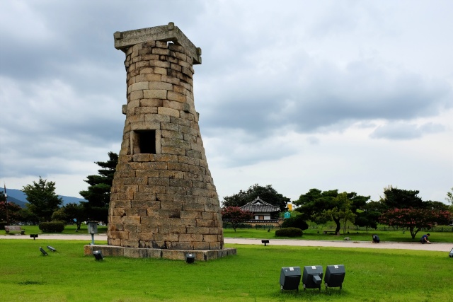
Gyeongju: Cheomseongdae – Observatory
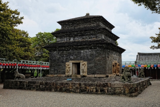
Gyeongju: Pagoda – highlight of Bunghwansa Temple
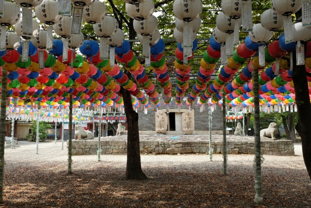
Gyeongju: Bunghwansa Temple
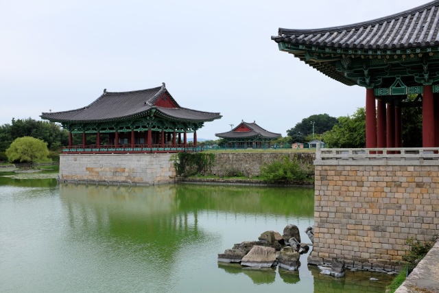
Gyeongju: Pavilions in Anachi Pond
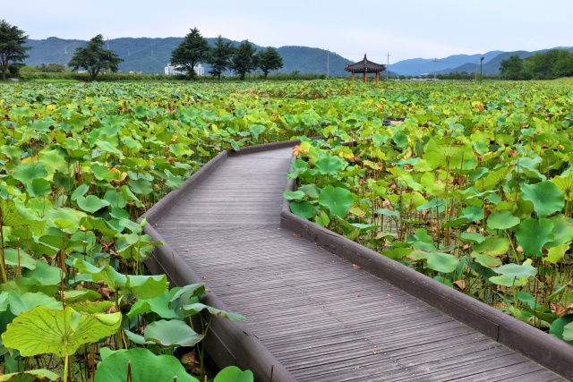
Gyeongju: Footbridge to the bower
There was so much to see, so I decided to stay in Gyeongju for another night. The accommodation was satisfactory, cheap, good quality with myself as the only guest in the entire hostel. This was not so strange, considering that there were about 20 motels in the area. The competition was strong. The next day I took it easy. I slept and ate properly and visited many sights, starting with a traditional Korean wedding in a themed village and ending in the National Museum.
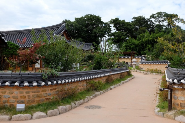
Gyeongju: Gyeongju hyanggyo – well-preserved village
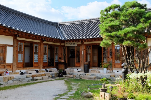
Gyeongju: Gyeongju hyanggyo – courtyard
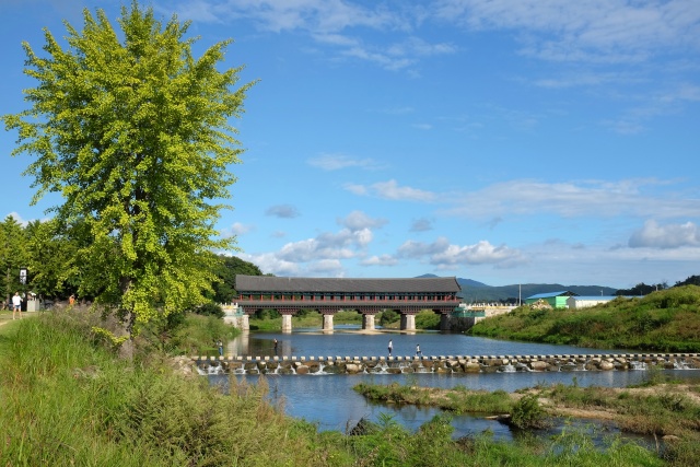
Gyeongju: Gyeongju hyanggyo – newly reconstructed bridge
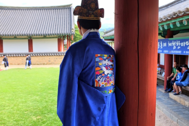
Gyeongju: Traditional Korean wedding – the groom nostalgically watching his freedom slip away
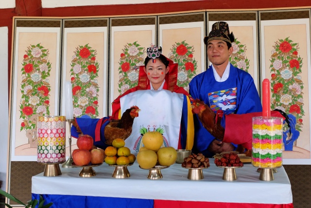
Gyeongju: Traditional Korean wedding – hen on the left, cock on the right and, behind them, bride and groom
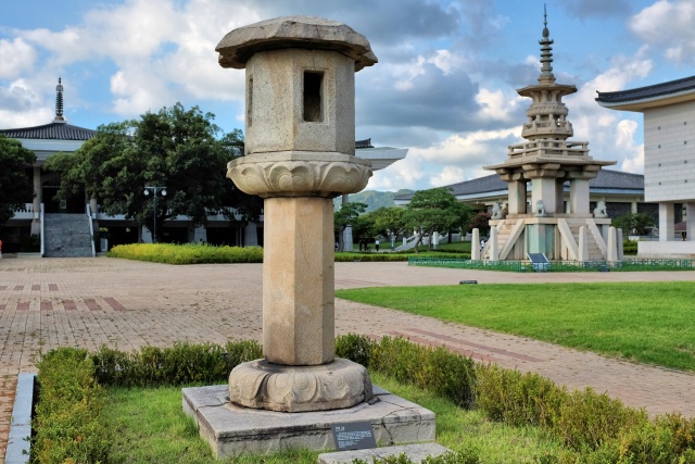
Gyeongju: National Museum – pagoda in the courtyard
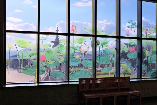
Gyeongju: National Museum – view of courtyard through the vitrage
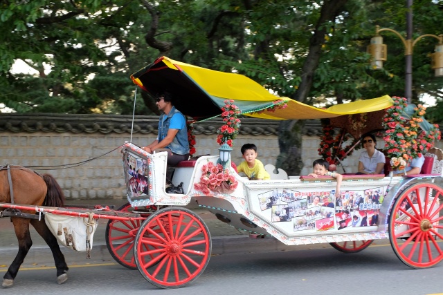
Gyeongju: Horse and carriage city drive for tourists
Yangdong Folk Village
Leaving Gyeongju was not difficult, easy navigation, little traffic. After 20 km I turned on to a road leading to one of the best-known local sights – Yangdong Folk Village. The village is spread out over a hillside in a forest. The houses have kept their original character, many with thatched roofs, with people living in them. However, neither cars nor bicycles are allowed in this village. This right is reserved only for village residents. The village is extensive with at least 100 houses, of which four are exceptional. I saw all of them, even though it meant walking for several kilometers over hilly terrain.
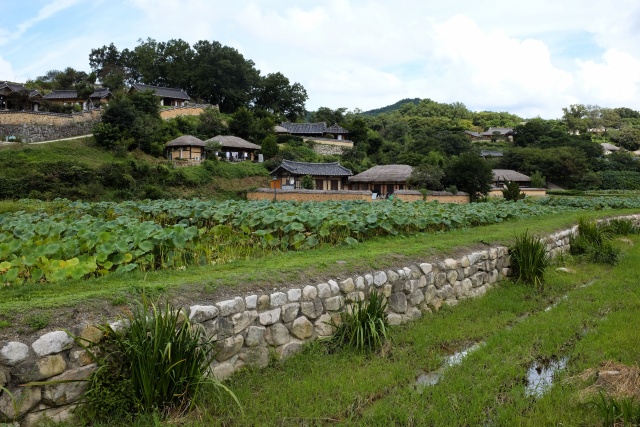
Yangdong village: Central parts of the village
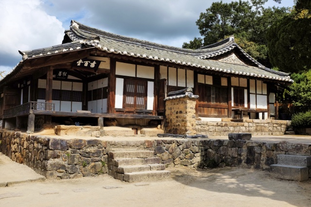
Yangdong village: The prized Seobaekdang – main residence of the Wolseong Son clan
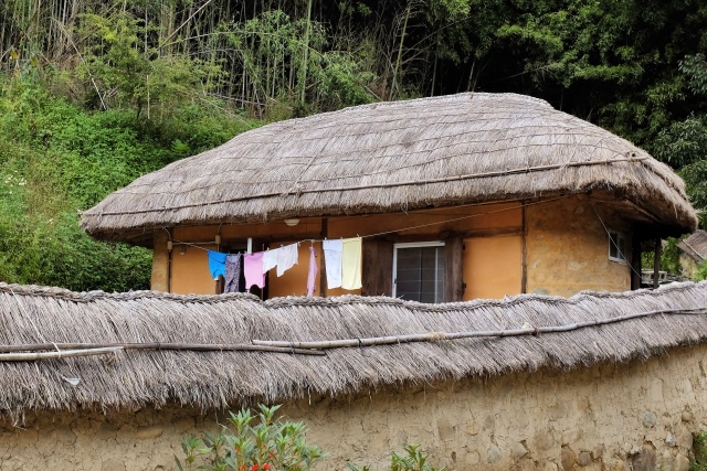
Yangdong village: People live as usual in most of the houses
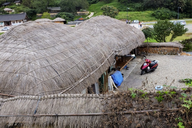
Yangdong village: Roof details
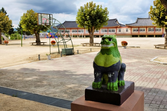
Yangdong village: Lion at school entrance
After the relaxing visit to the village, I had a shock when passing through Pohang city. Just like the majority of larger Korean cities, Pohang had busy traffic, hilly terrain and drivers, unused to cyclists, driving unpleasantly close by. I was not really enjoying this 15-km ride through the city, so I appreciated the bypass leading along the coast. I passed several fishing villages and saw several renowned beaches. These are evidently of a lower standard than the destinations where Czech tourists usually go. The villages are notably messy, with things lying around the houses. In addition, one comes across unconventional (often weird) motels and recreational camps. There was always something to look at and the road passed quickly.
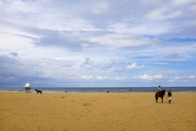
Chilpo: Chilpo sandy beach
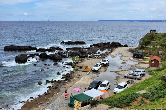
Wolpo: Coastline
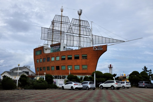
Near Bangseok: Motel and Café
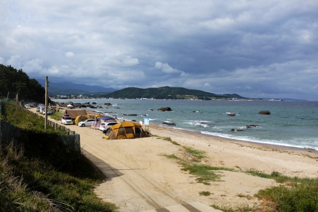
Near Bangseok: People camp on the beach where possible
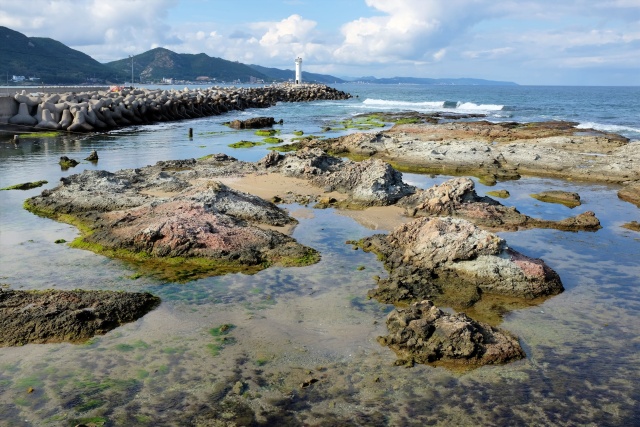
Daeleon: Lighthouse at the coast
Along the Seashore
The forested areas between the road and ocean were often occupied by 'illegally' camping Koreans. They often chose places with working bathrooms and running water. It was, however, notably the end of the season and there was often no running water in public fountains and rest places. This is why I was not so concerned about finding a place to sleep. I would simply find a spot near a beach. At 17:30 I finally started searching for that spot, with only one hour in which to do so before sunset, when cycling would become unsafe. I had no luck and could not find anything. Finally in Ganggu Harbor, at about 18:30, I noticed a sign pointing to a football stadium. Although I had to cycle up an elevation of about 100 meters, it was totally worth it. Working bathrooms, open 24 hours a day. A spot beside the tennis courts became the ideal campsite – roof, benches, short grass, fountain with running water and even a hosepipe which served as a shower. No people around! Up to that point, this was the best overnight spot I had found that year.
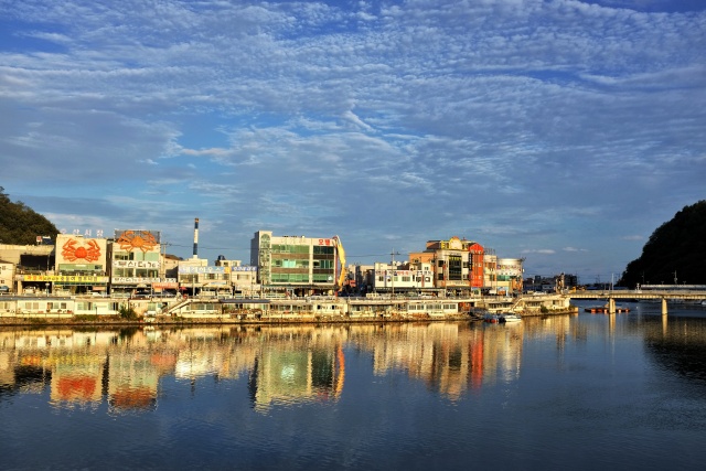
Ganggu Harbour: Buildings in the evening sun
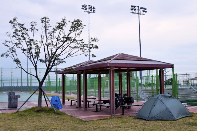
Hanggu Harbour: Comfortable camping in the sports complex – water, seating, trash cans at hand, bathrooms 50 m away
The following day continued in the same spirit. Cycling on local roads along the seashore. Where it was not possible, I took Road 7, which was marked as a 'motorway', on which neither scooters nor bicycles were allowed. However, bicycles were tolerated in the areas where no other alternative was offered. The traffic was unpleasant, but the side lane was about 1 meter wide, although often destroyed by gravel. Sometimes the road went through a tunnel and I was stressed by the noise of the passing cars. The 'rest areas' were great. Besides the pump which was always there, there was usually at least one self-service restaurant with photos of the meals. I ate in one of them and even bought the local variation of sushi as a take-away for breakfast.
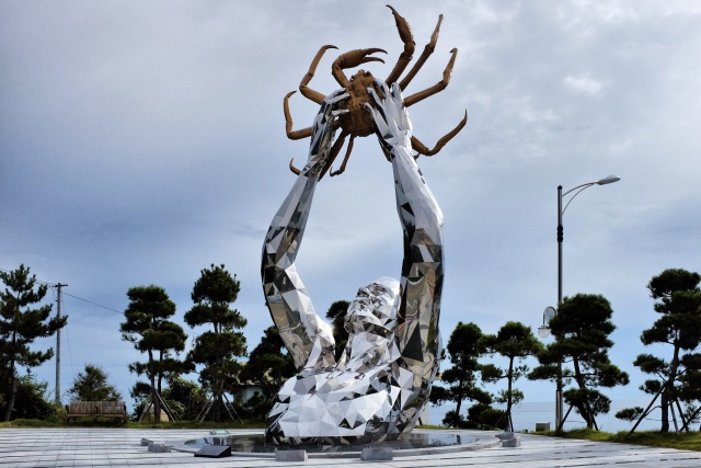
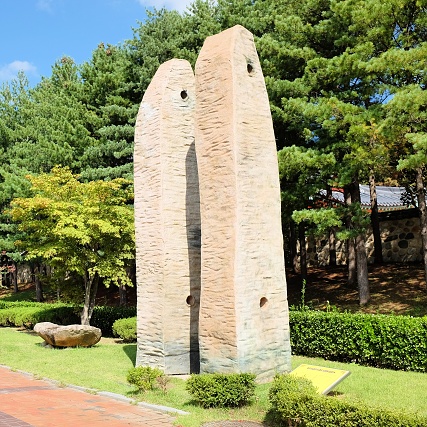
Near Haio: Exquisite sculpture at entrance to this otherwise neglected fishing village
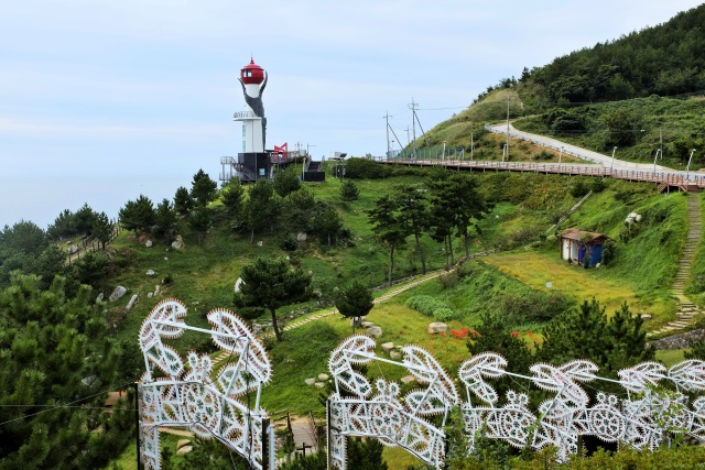
Haio: Lighthouse in the shape of a crab claw
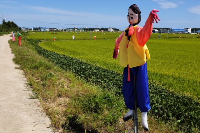
Seongnae: Village advertising itself with hundreds of scarecrows in the cabbage field
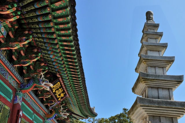
Wolsong: Buddhist sanctuary
In Wolsong, the historical Wolsongjeong pavilion is beautifully situated on a moderately steep slope above the sea, surrounded by an extensive pine grove. Young aristocratic warriors had used it for meditation. In the same site there is also a touristically unexploited Buddhist sanctuary, which I really enjoyed viewing. The entrance was through the courtyard of an ordinary house. I was unsure, but a lady came out and said that I could open the gates and go in to see the sanctuary. Afterwards, she even invited me in for a meal, but I thanked her and declined, as I did not want to stay there too long.
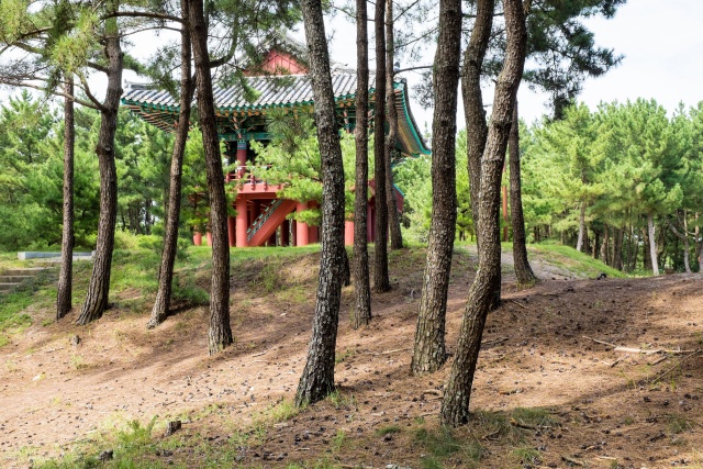
Wolsong: Wolsongjeong memorial pavilion by the sea
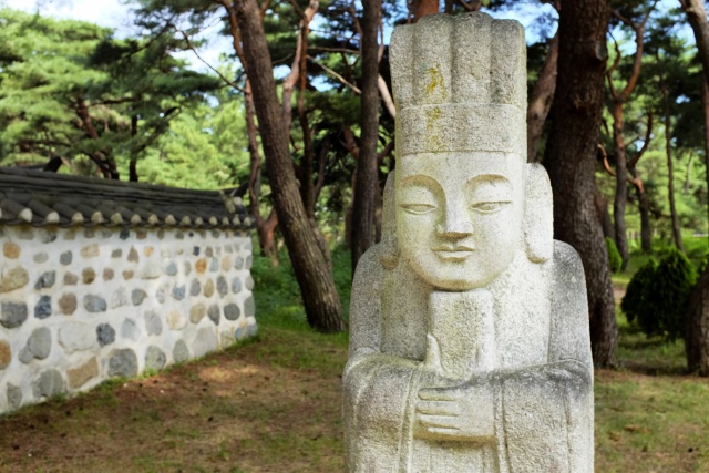
Wolsong: Sculpture in front of the sanctuary
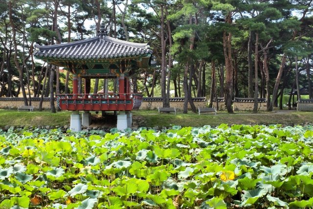
Wolsong: Pavilion in the park
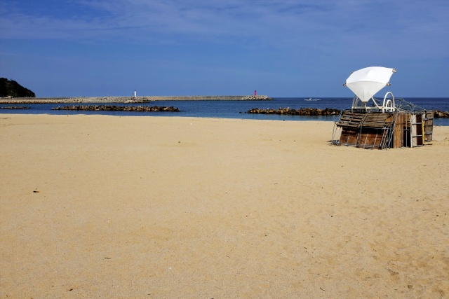
Gusan: Local renowned beach
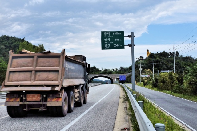
Mangyang: Road 7 – top right, statue of the Buddha peeping out
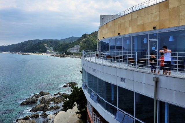
Mangyang: Roadside service station, in the background – the tunnels I rode through
I camped out on a beach in the company of several Korean tents. I had the feeling that the people occupying them were there permanently – at least during the season. The only disadvantage was the closeness to the road. However, despite the noise, I slept well. The following day was similar to the previous one – where possible, I cycled beside the sea or on local, slightly hilly roads. I accidentally cycled on a stretch of about 10 km of a 'motorway', as the usual sign forbidding cyclists was missing. In the evening I reached Samcheok, a relatively large city.
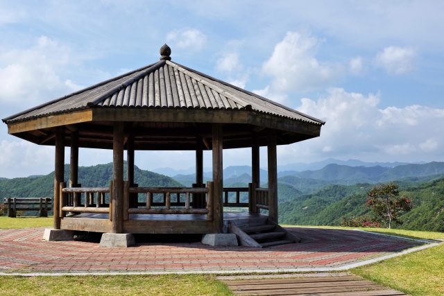
N of Bonggyeong: Pavilion on top of the hill
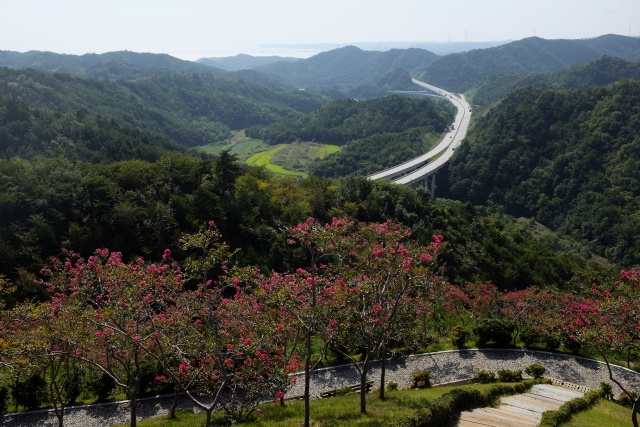
N of Bonggyeong: View over highway 7 to the south
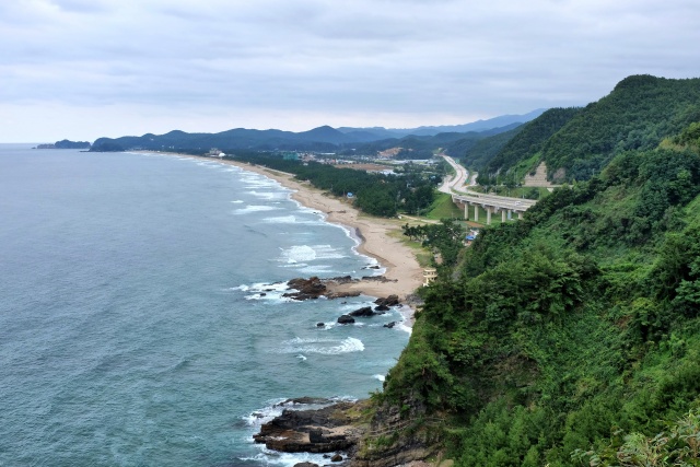
S of Samcheok: Coastline
I had found out that a campsite was located 15 km north of the city, so I headed towards it. At 18:00, about 6 km from the campsite, I found that I had a flat front tire. I knew that I would not make it to the campsite before dark, so I pushed the bicycle the 300 meters back to the outskirts of the city, to a small park with dry toilets and running water, which I had earlier passed. I wondered how I could have punctured my new super Schwalbe Marathon Mondial tire so soon after its purchase. When I repaired the tube the following morning, I found that it had been punctured by a thin needle, which broke when I tried to pull it out. A small piece remained stuck in the tube, no matter how hard I tried to remove it. I used a stone to press the needle inside and used a plaster around it on the inside to seal it. I had not forgotten the campsite only 5 km away. I impudently entered it, parked in front of the showers and enjoyed the first hot shower in three days. The campsite was fairly good, with tables and benches and well-used washers in the kitchen, which had a broken lock on the door. The campsite was quite full, considering the local density of campers in general, and it was probably also free, but I did not know this for sure, as there was nobody at the gates when I arrived.
Jeongdongjin
My destination was Jeongdongjin, an interesting town on the coast. The road leading to Jeongdongjin rapidly ascends, while the parallel Road 7 goes along the river almost without any increase in elevation. I was puzzled by this and checked the GPS, as both roads later cross. It was apparent that Road 7 would be a better option. However, I did not succumb to this temptation, but bravely peddled uphill on the narrow road, while at the same time cursing myself at times for not having taken the easier road. Finally, I was proud of my decision, as the hilly road and Road 7 did not actually cross at all, so I would never have reached Jeongdongjin on Road 7. When I arrived in the little town, I was surprised to see a hotel in the form of a trans-ocean liner built on the cliff above the beach. I have a hard time understanding why people invest so much money and energy in such corny things. However, it might work just as well in Korea as in other countries. One thing was certain, this hotel-ship can not be missed and everyone takes at least one photo of it.
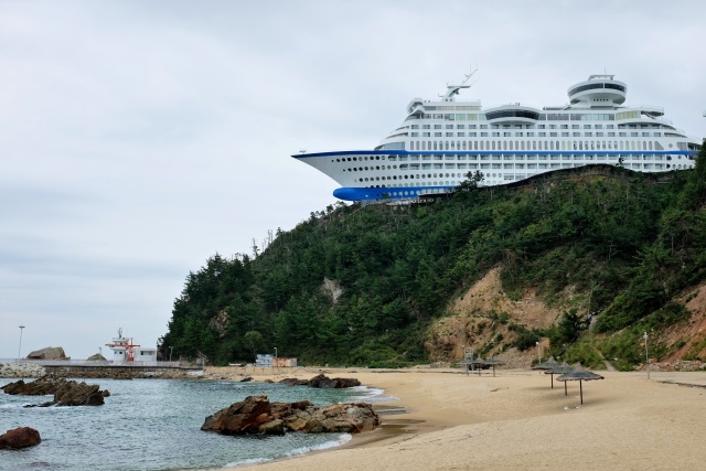
Jeongdongjin: Hotel in the shape of a ship
There are other sites of interest in the town, though. The huge hourglass is amazing. It takes exactly one year (precisely in seconds) for all the sand to pour from one section to the other. In the first second of the following year, the hourglass is rotated and then the sand again trickles through for another year. To ease and speed up the rotation of the hourglass, it is placed on rails. My technical common sense pondered a lot about this – there are countless facts influencing the hourglass, for example, every single grain of sand needs to be identical, of the same moisture, etc. Another method is that of a technically practical solution – which seems to be the case. As the hourglass is sponsored by Samsung, it could weigh one of the sections (upper or lower) and, in the case of a delay, shake the device a little. One can ponder a lot while cycling.
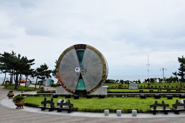
Jeongdongjin: Hourglass measuring a full year
I could not miss out on the Deungmyeongrakgasa Temple, located at the roadside. The ceiling with dragons on the entrance gates was quite impressive. The exteriors of the buildings were decorated with paintings and I took a photo of an intelligent beauty on a bed. It was just shortly after midday and she already knew where to lie down for the night. I usually only find this out just before nightfall.
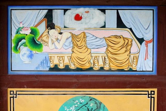
Deungmyeongrakgasa Temple: Wall painting in the chapel
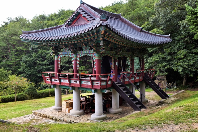
Deungmyeongrakgasa Temple: Bell tower
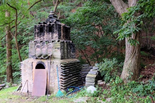
Deungmyeongrakgasa Temple: Pagoda made from roof tiles – evidence of local creativity
Tongil Park
The most famous site, if one can call it that, is Tongil Park where the North Korean submarine is the highlight of the exposition. It arrived in secret in South Korea in 1996 with 25 seamen on board, three of whom went ashore. Due to bad decisions, the submarine went aground on the coastal rocks. The seamen set it on fire, to obliterate any compromising documents and then deserted it. The anti-spy operation took 45 days, one of the spies was captured alive, 13 were killed by South Koreans and 11 were killed by their own mates from North Korea. South Korea lost 17 victims, 6 of whom were civilians. This incident triggered the need for better defense and one could see it everywhere in that region. The coast is lined with a razor-wire fence and is floodlit at night. The gates to the beach are open during the season, but are totally closed out of season. A military watch tower is situated every few hundred meters — the full scope of the Iron Curtain!
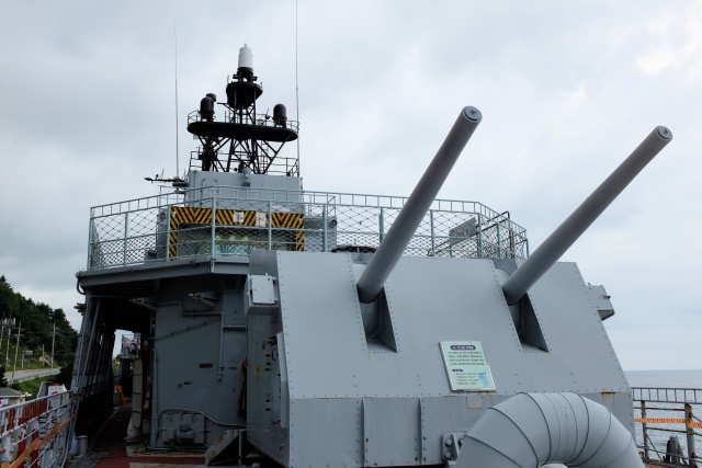
Tongil Park: American warship
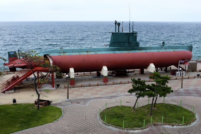
Tongil Park: North Korean submarine
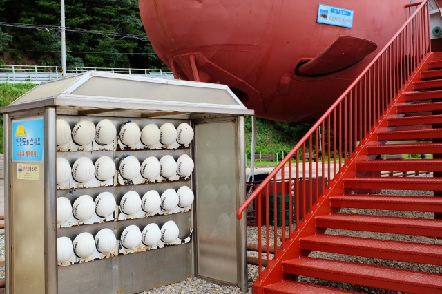
Tongil Park: Before boarding the North Korean submarine, it is advisable wear a helmet to prevent head bumps
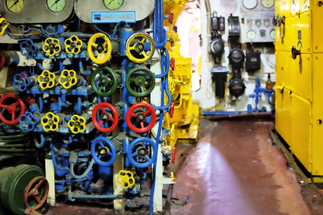
Tongil Park: Sailors on the submarine definitely could not have been colorblind
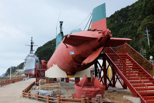
Tongil Park: Seized North Korean submarine with American warship in the background
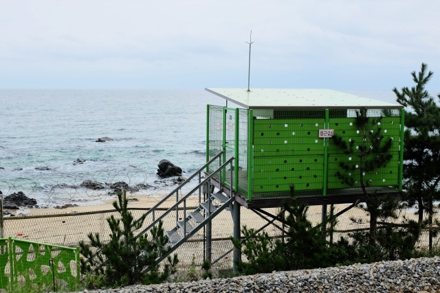
Near Jeongdongjin: Fenced-off beach, Korean military guard post
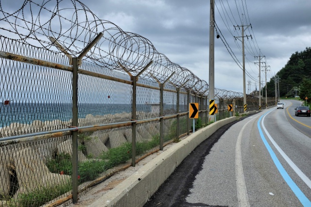
Near Tongil Park: Fenced-off beach – North Korean spies will not enter again
Gangneung
Originally I intended reaching Odaesan National Park and spending at least one day hiking it. But I had no such luck. At 14:00 a massive storm arose, and my jacket, purchased 5 years before in Japanese Kagoshima and well impregnated before the trip, lasted about half an hour. I reached the fairly big city of Gangneung in the rain. Following the signs, I arrived at the railway station. Not that I wanted to continue by train, but around railway stations and bus terminals there is usually cheap accommodation. I found a moderately low-quality hotel and bargained the price down to 600 CZK ($30) per night. The owner was quite affable. Although we did not understand each other at all, she washed a load of my clothes. This was the best thing to have happened to me, regardless of the fact that she refused to accept any payment for the washing. The rain was not easing off. On the contrary, every last item of my clothing was soaked on my walk back from the center. Luckily there was a hairdryer in the room – an invaluable aid for drying shoes!
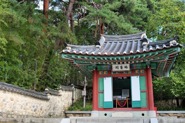
Gangneung: Ojukheon – pavilion
Gangneung: Ojukheon – very valuable flag holders
Gangneung: Ojukheon – courtyard
The following morning was like a painting: azure blue sky. I had plenty of time. I got going at 10:00 to see the local sights of interest – a complex of Ojukheon Houses. The site is connected with the medieval poet and philosopher, Le Yulgog, commonly known under the pseudonym of Yi-I. His fame is so great that his portrait can even be seen on a 5000-Won note. Pleasant place, well kept. Then I cycled to the coast, saw several memorial buildings and pavilions. I even passed a Museum of Gramophone Records connected to the Museum of the famous American inventor, T. A. Edison.
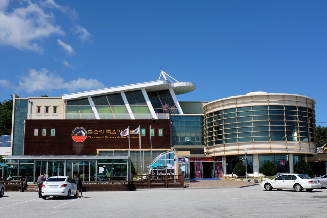
Gangneung: Museum of Gramophone Records
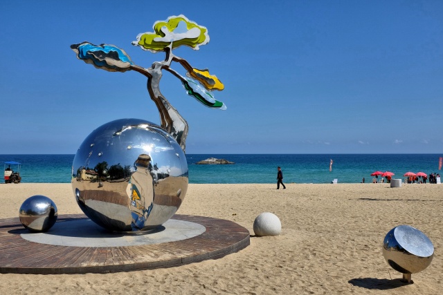
Gyenpe Beach: Beach sculpture
I passed a series of beaches with beautiful golden sands, fringed by a row of lush green pine forest. The first one was the nicest — Gyeongpo Beach. The others were surrounded by a barbed-wire fence with the gates already closed for the season. I ate at Jumunjin Market and then returned to Road 6, which passes through the National Park.
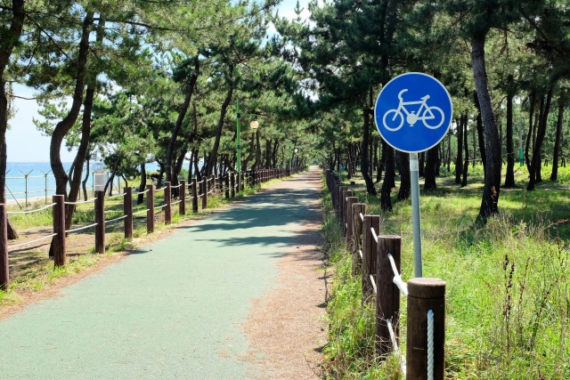
Sungeut Beach: Bike path through pine forest at the beach
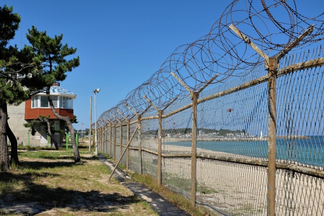
Sungeut Beach: Fenced-off
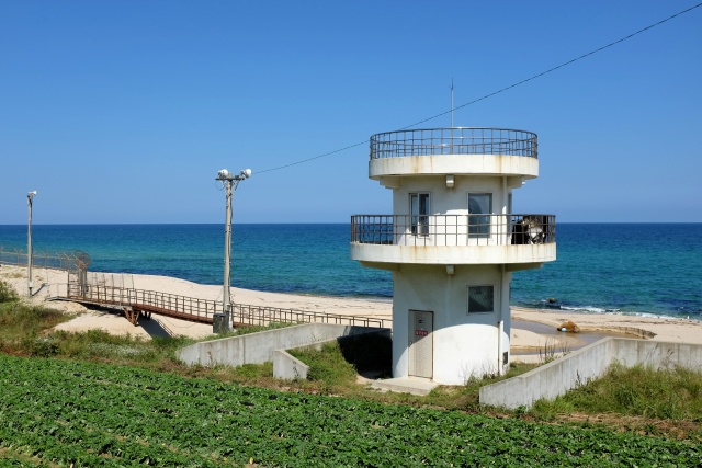
Sungeut Beach: Military loudspeakers
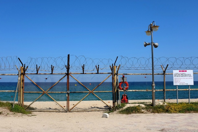
Yeongok Beach: Closed gates to the beach, it was off-season
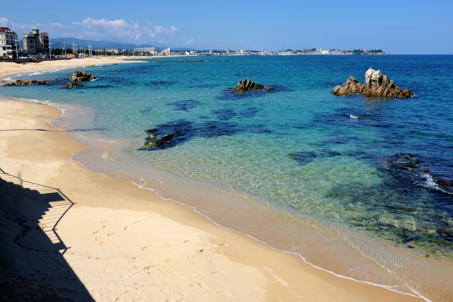
Jumunjin: Cove
Odaesan National Park
Koreans are keen travelers. Especially older people enjoy this activity. Every big city offers a vast number of international trademark outdoor-activity stores, selling mainly clothes and shoes. A good Korean tourist needs to have a hat, if possible in multiple colors. As I did not want to stick out from the crowd, I purchased an elegant, although unicolor, Reebok hat for a modest 200 CZK ($10). This ensured that I did not need to be ashamed while trekking.
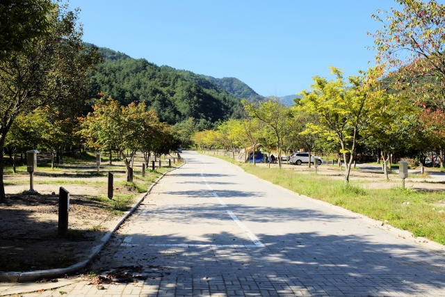
Odaesan National Park: Autocamp at park entrance in Sogeumgang Valley
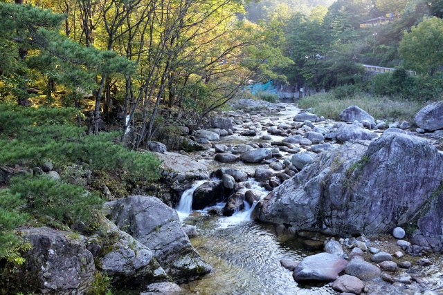
Sogeumgang Valley: Creek
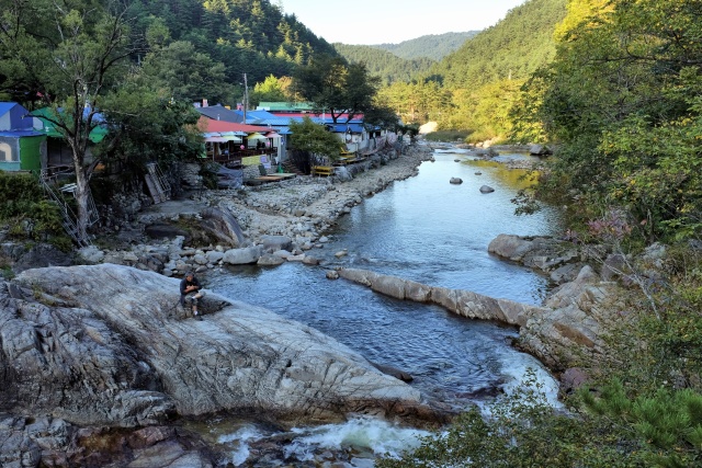
Sogeumgang Valley: Valley
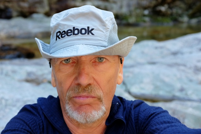
Odaesan National Park: 'My new hat is a Reebok'
The Park had two entries. I chose to enter through the northern gate, through the Sogeumgang Valley, about 20 km from the sea. The road ascended a bit, but nothing dramatic. I pitched my tent in the campsite located outside the Park entrance. This was also the first time I paid for camping in Korea – about 320 CZK/day (approx. $16) . There was no entry fee to the Park itself. I had obtained some provisions earlier on, as I had no idea if anything would be available in the Park. It transpired that this was to be the second time in Korea that I cooked something for myself other than a cup of tea. I made my usual spaghetti with tuna. However, there was really no lack of food, considering the approximately 20 pubs near the Park gates, serving meals as well as the treacherous Makgeolli as well as Soju and other local beverages. This time I made sure to avoid those.
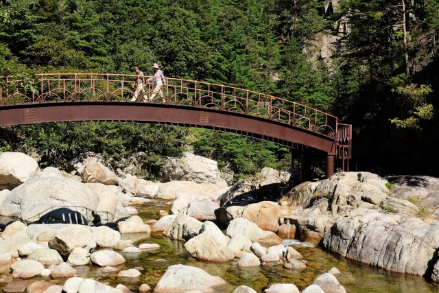
Odaesan National Park: The hiking trail in the river valley has many bridges
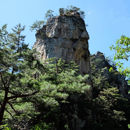
Odaesan National Park: The valley is lined with impressive rock formations
I hiked for about six hours around a brook, which formed narrow canyons and a number of waterfalls. There was even a secluded Buddhist temple to be seen! There were many tourists. I even met a young Canadian woman from Montreal and walked and chatted with her for about half an hour. The path often crossed over small zig-zag bridges from one side of the river to the other. Higher parts were a bit more demanding, especially on my sandals and I had to be careful not to twist my ankle, which would have ended my trip. Nevertheless, I enjoyed the hike very much: dramatic countryside, deep forests, hills, roaring water in the river struggling through the rocky terrain.
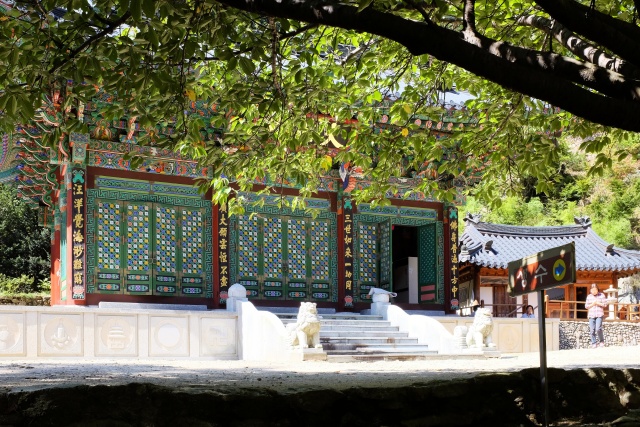
Odaesan National Park: Geumgangsan monastery
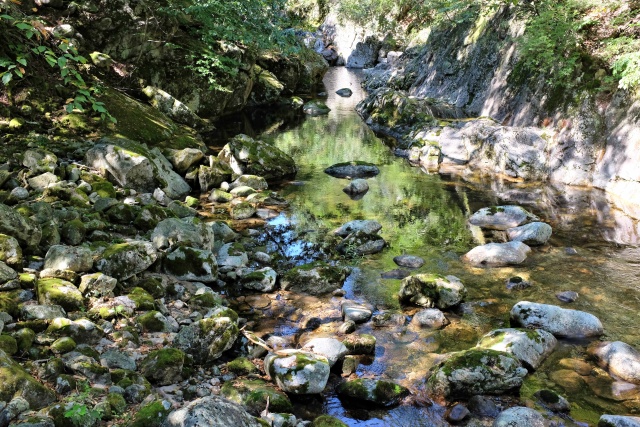
Odaesan National Park: River bed covered with large boulders
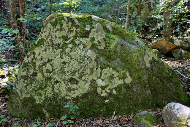
Odaesan National Park: Rock overgrown with lichen
After the trek, I still had loads of time. My clothes were washed, so I invested the time in the bicycle. I washed the chain with the local variant of WD, oiled everything, checked that all the screws were tightened on the racks, adjusted the gears and pumped the tires. Everything was ready for the journey to continue. In Gangneung I purchased a large rear blinker, to accompany the one I had on the helmet, for greater visibility in tunnels. I removed the packaging of this cheap product – Made in China (120 CZK, $6) – inserted the batteries and – nothing happened. I changed the batteries again – nothing happened. I tried my best for about 15 minutes, before angrily throwing this 'lamp on strike' into the grass. And suddenly the unbelievable became reality (as Hrabal, a Czech classic writer, would say), the lamp started flashing for dear life and I had no problems with it from then on.
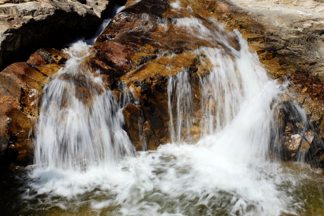
Odaesan National Park: One of the waterfalls
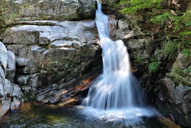
Odaesan National Park: Sesim-p'okp'o waterfall – lower part
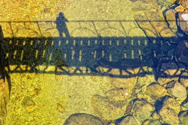
Odaesan National Park: I photographed small fish from the bridge
Further Progress
Not far north of Odaesan is Seoraksan — one of the most beautiful Korean National Parks. Naturally, I could not miss out on that one. However, I was a bit unsure whether I wanted to visit the Observatory of the Demilitarized Zone. It was about 100 km to Seoraksan and then an additional 60 km to the Observatory. I pondered about this en route and finally the timing decided for me. I would reach Seoraksan on a Saturday and could undertake the trek on the Sunday, when the Park would be exceptionally packed with Korean tourists. That is why I chose to visit the Observatory and Museum of the Demilitarized Zone first, return to Sokcho and on the Monday visit the National Park.
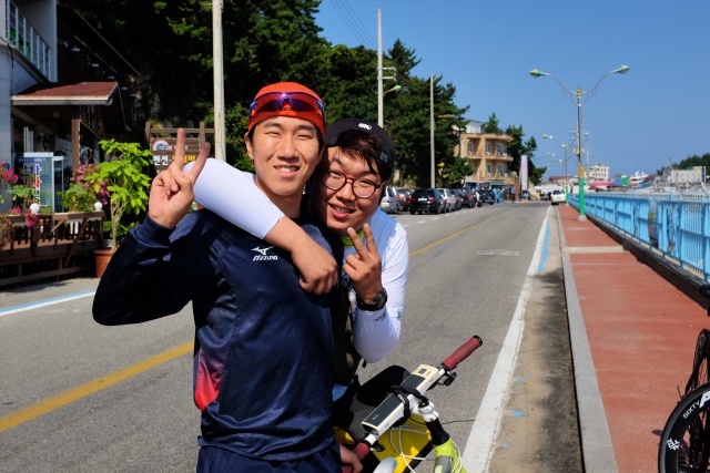
Namae: Minjo and his friend
I overtook two cyclists in Namae, both traveling light. One had an Ortlieb handlebar bag and a rear pannier of the same trademark. This was a sign that he could be a long-distance traveler. I asked and bingo – Miòo proudly announced that he had been on a European cycling trip before, when he had cycled 5000 km over a three-month period. He had even visited the Czech Republic – Prague and Èeský Krumlov and South Bohemia. He could pronounce Ahoj (hi) and Na zdraví (cheers) very nicely. Here it became obvious what Czechs taught their tourists – to drink beer. He was really enthusiastic about it and I got to learn another Korean word: kombe, which means Cheers! I longed to use this phrase in the near future.
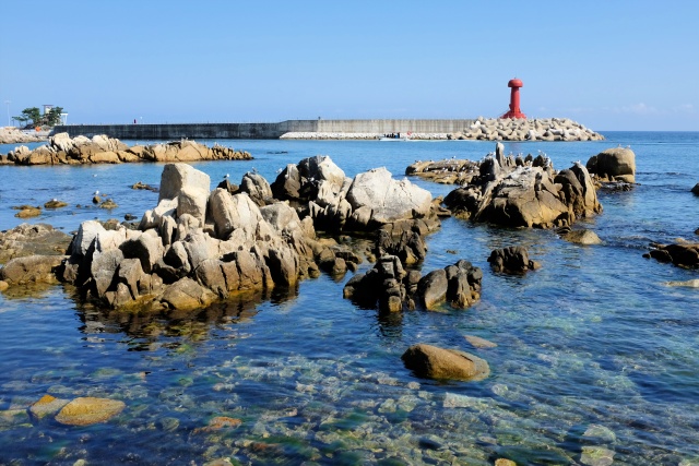
Namae: Coastline
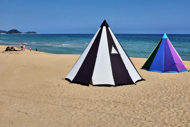
Namae: Tents on the beach
It was a Saturday, nice, sunny, warm weather. I went as close to the ocean as possible – following the signs proclaiming 'Romantic Korean Road.' Crowds of people, many surfers everywhere, even though there were no big waves. There were also many divers in neoprene. Before reaching Gwangjin Beach, I came across a Buddhist Temple, with a truly fascinating interior decor. Relaxed atmosphere, children were making the heavy clapper swing to ring the impressive bell. The money boxes in the temple were getting fuller and everyone was happy. The Buddha statue smiled ambivalently at all of it.
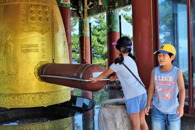
Gwangjin Beach: Kids ringing the bell in a Buddhist chapel
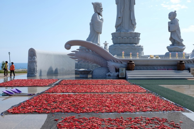
Gwangjin Beach: Food has a higher priority than ideas, peppers must be dried somewhere
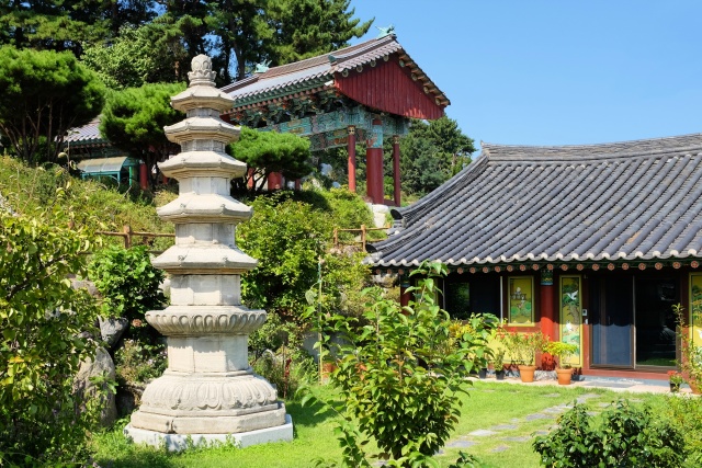
Gwangjin Beach: Pagoda
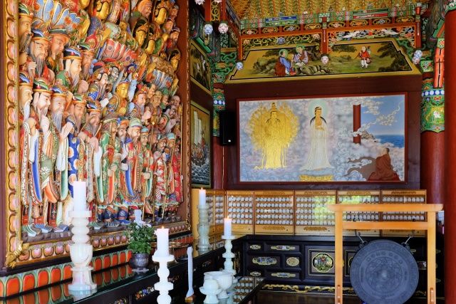
Gwangjin Beach: The interior decoration was amazing, even on the less exposed side walls
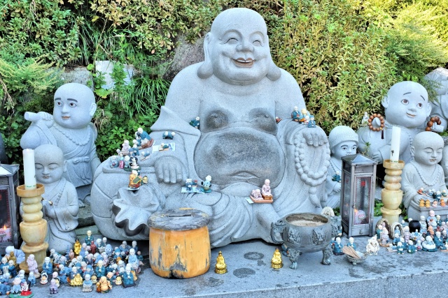
Gwangjin Beach: The Buddha has a sly smile on some statues
I managed to eat all my food supplies in Odaesan and was left with only a few biscuits and tea for breakfast. This is why I welcomed the service station with two restaurants at the 38th Parallel. They had no photos of the food, so I ordered according to my current taste. I had earlier learned the names of the main Korean meals, so when in a pub I recited them until the waiter would nod his head at something. I started with jjin-mandu (filled steamed dumplings) – they did not have them. I tried dak-gogi (chicken) – no luck. I did not feel like sogogi (beef), but possibly bulgogi (marinated beef) – they did not have that either. So I tried bibimbap (stew of rice, vegetables, egg, sometimes meat) – and succeeded. Otherwise my next try would have been myeon (noodles) or makguksu (noodles with meat). In the worst case scenario, I would have ordered sundae (filled sausage). The food is usually very spicy in Korea, which was the fault of foreign businessmen (from Europe), who introduced chili peppers to Koreans in the 17th century. The bland Korean food then started to be seasoned. The result of this is the highest occurrence of stomach cancer in the world. The problem is not caused by eating spicy food over a certain period, but if it is eaten daily for many years, the stomach does not have any break from it and reacts with cancer. At that time, I was able to digest everything, even though I had been warned about the spiciness of the food.
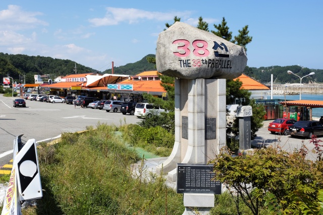
38. Parallel: The service station – my highest priority due to a lack of food
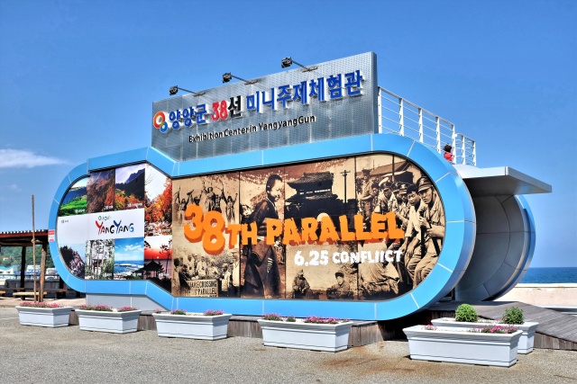
38. Parallel: Mini museum commemorating the ferocious battle
Even in this region, good bike paths were to be found – if one could locate them. In the following year a cycling path from Busan to the north was to be completed. During my visit, the paths were unconnected 'islands'. However, as I have already mentioned, people did not respect the paths, they used them for parking their cars or drying their peppers and rice.
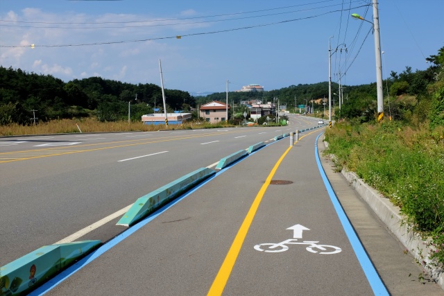
S of Sokcho: It is cheaper to build a bike path beside the road
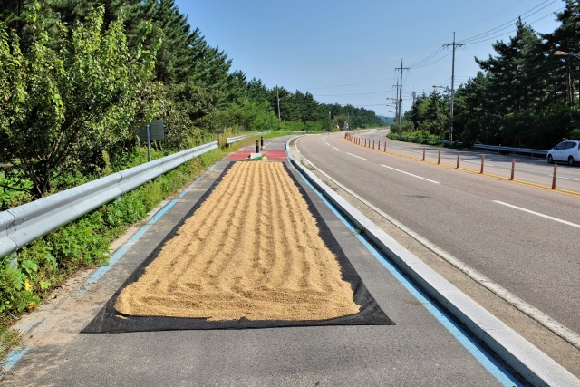
S of Sokcho: A local farmer (perhaps even a kulak) drying his harvest on the bike path
Hwajinpo
The day was approaching its end. It was 17:30, so I started searching for a place to pitch my tent. It could be pitched almost anywhere, but I tried to find a spot meeting my criteria: water and a toilet. In Hwajinpo I saw signs pointing to the local Aquarium and Museum of Ecology, so I suspected that could be the place. At the Aquarium it was fine – good toilets, outside faucets with running water and a little park across the road. Everything was perfect. As it was still light, I went to see the Kim Il-Sung Villa (alias Kim Ir-sen), where this founder of North Korea often liked to stay, until he lost this part of the country in the Korean War. The villa is located on a hill above the sea in a pine forest with beautiful views of both the beach and lagoon. The site appealed to me. If it had been good enough for Kim, it was good enough for me. Toilets and running water at the site. I made my bed right in the gazebo, 150 meters from the villa. My dreams were entered both by the humming of the sea and sometimes even the radio transmitters of the guard boats and patrolling military guards. Btw. the beach is very suitable for bathing, but one is not allowed to swim out very far, as there are traps placed for North Korean divers.
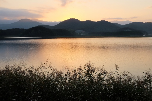
Hwajinpo: The sun is setting and I search for a place to camp
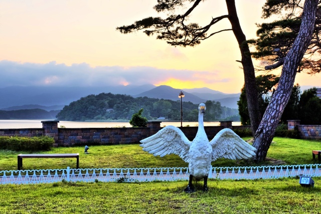
Hwajinpo: In front of the Ecological Museum, I had to pretend to take photos since the guard rightly suspected I was searching for an overnight campsite
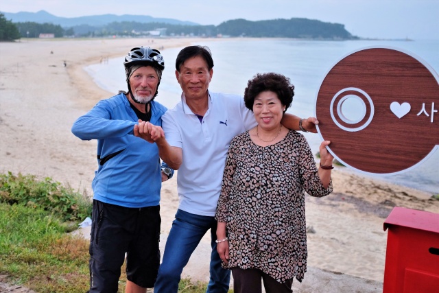
Hwajinpo: Koreans are very sociable
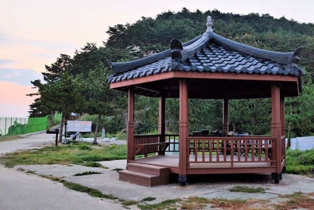
Hwajinpo: I found a spot 150 m from the residence of Kim Il-Sung (white spot above pavilion) – better known as Kim Ir-sen back home, due to previously used Russian transcription
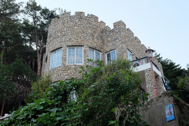
Hwajinpo: The villa is currently called Kim Il-Sung Castle
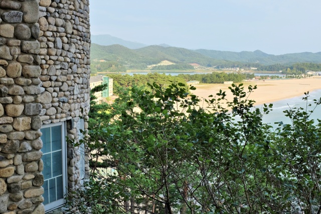
Hwajinpo: From Kim's villa – magnificent view over the sea and inland lagoon
Get Out of Here
I was unintentionally woken by a five-member military guard, who had come to rest and chat at sunrise in the nearby gazebo. I left already by 7:00, I was only 16 km from DMZ (Demilitarized Zone). I passed a registration center, but it was too early and there was nobody there. 6 km from the Observatory was a military checkpoint where I was refused entry on my bicycle. I tried to convince the Commander, with hands and feet. He was very friendly, but adamant. It was not possible to continue by bike. I had asked about this a few days before in a tourist office, where they confirmed that the Observatory was accessible to tourists. They had forgotten to mention, or did not know, that this was only by car. There was no bus service, only tour buses. I waited for two tourist buses, but was not able to communicate with the drivers. Half an hour later, I gave up and headed back south towards Sokcho. There was no possibility of continuing further northwards.
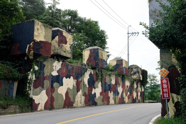
Near the border with North Korea: Everything here is already under military control
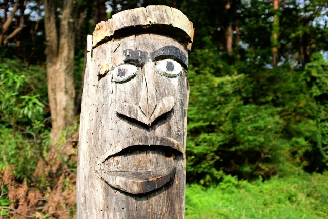
Near the border with North Korea: En route to the Korean 'iron curtain' observation point, soldiers at the checkpoint wouldn't let me through on my bike – my disappointment and protests are evident
I had plenty of time, I enjoyed the quiet small roads along the shore, passing little harbors and beaches. It rained for about two hours. Not very much, but persistent drizzle can soak one totally unnoticed. I did not fall for this and instead sweated in my waterproof high-tech "breathable" clothes.
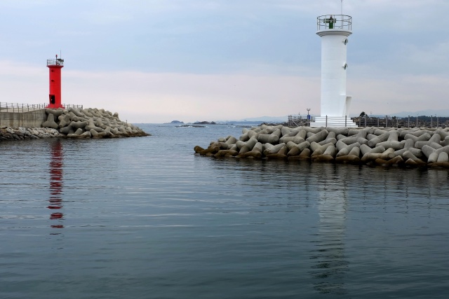
Baekdo Harbour: Lighthouses at the harbor entrance
At Kim Villa, I received a WiFi signal from a nearby condominium. I used it to locate a room with a bathroom in a hostel in Sokcho center for 400 CZK ($20) . The only problem was finding it. Already at home I had downloaded a Korean map to my GPS, but still it did not know the majority of the streets and the calculated routes were often inaccurate. I usually tried to find a place on Google maps, and then entered the coordinates into the Garmin, which I then followed. I was lost for a while, but finally found an outdoor K2 store, which was supposed to be in the vicinity of the hostel. I did not see any hostel, until the K2 staff pointed at a building without any sign. It was locked, only the phone number was displayed. My old-type mobile phone did not function in Korea (apparently). I asked the sales clerk in the nearby store to call that number for me. It worked and soon afterwards, I was lying in a large, clean en-suite bedroom.
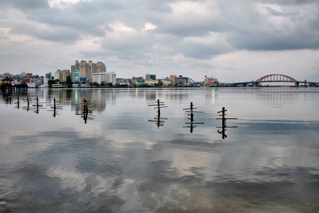
Sokcho: Inland lagoon
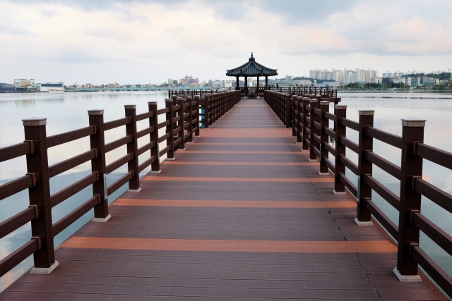
Sokcho: Pavilion on the lagoon
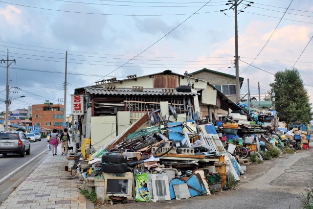
Sokcho: Only two blocks from the city center, already the classic Korean farmland
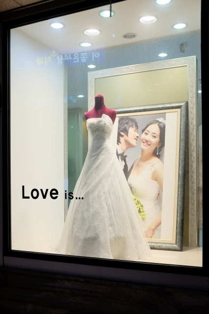
Sokcho: Love is...
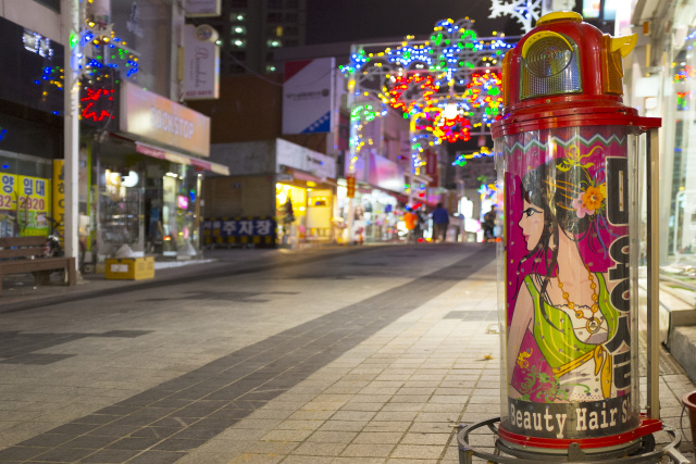
Sokcho: I don't need another haircut yet
