|
Along the Orange River to South Africa
Food, Grub – Fill All the Bags
In the following days, I was to cycle through a desolate area and so I had to restock my food supply. I visited the three biggest supermarkets, all conveniently located in the vicinity of the hostel and bought supplies for several days in advance. On the following day, I would have a problem stuffing it all into the bags, but after three days the bags would be pretty flat again. It always really amazed me how quickly the food disappeared. And, by the way, natural gas cylinders for cookers were available in two out of the three supermarkets so a natural gas cooker would not have been a problem in Namibia. The next day, I would buy a liter of gasoline at the gas station and replenish that stock too.
I returned to Seeheim. I do not like traveling along the same route, but this was the only possibility of a campsite en route to the Fish River Canyon. I was welcomed like an old friend, and immediately given a Windhoek Lager from the fridge, so everything was A1. I was the only guest both in the camp and hotel. I did not understand how this business could support them. And I did not even have dinner, because the last time it was not worthwhile. I enjoyed a long Saturday rest, so I cooked from my supply, washed my clothes and studied the guidebook and map of South Africa in particular, to clarify the next steps. The route was already taking shape. I would try to avoid large cities and focus on the National Parks and Nature.
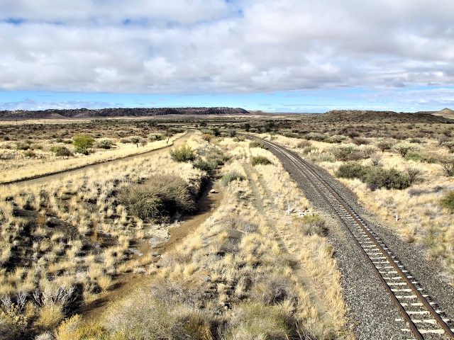
[20 km west of Keetmanshoop] Unusual phenomenon in the Namibian sky - clouds
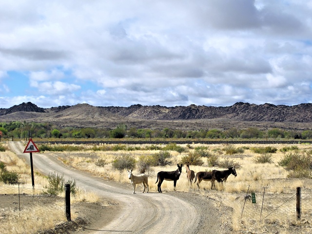
[25 km west of Keetmanshoop] Donkeys observe me curiously
In Seeheim the dirt road started again and I would only reach tar once in South Africa. However, the road was surprisingly good, a little sand, but essentially flat and windless. I easily reached the almost 100 km distant Canon Roadhouse and stopped over at the local campsite. Although the next camp was just 10 km away, I would have had to pay a daily tax of 80 N$ per stay in the National Park, so it would be an unnecessary expense. Instead, I had a good dinner which cost just a little more than the 80 N$. The camp was a short walk from the main building, yet freely accessible and full of people, so after some time, I again stuffed the bags into the tent. The bags fitted inside without a problem, but the space remaining for me was very limited. But nevertheless, I slept like a King.

[Holoog] Old lime kiln (at least I think it was one)
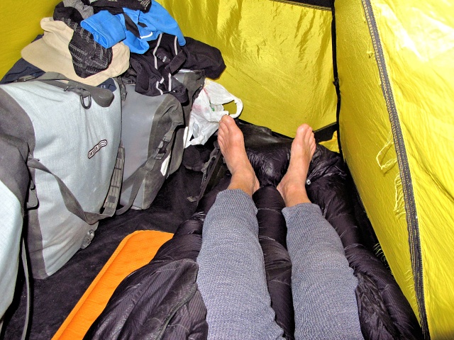
[Canyon Roadhouse] I have a small tent and such long legs - once a popular Czech song and reality for me when I put my bags in the tent
Fish River Canyon
The Fish River Canyon is the second largest canyon in the world. Only the Grand Canyon in the USA beats it. But the differences are considerable. The upper level of the Grand Canyon is covered with trees and greenery, which contrasts with the yellow, orange and sometimes red walls of the canyon. The Fish River Canyon is also a wasteland at the upper level where occasionally there are areas overgrown with cacti or quiver trees, but otherwise it is just a plain full of stones. The Fish River Canyon has two levels and the lowest, about 550 meters deep, is formed by the river. A quite demanding five-day trek leads through the canyon, but it is necessary to register for it at the NWR in Windhoek. Of course I did not go for the trek, I was not equipped for it.
The gate to the National Park is in Hobas, the daily admission was really 80 N$, as I have already mentioned. A 10-km long, miserable and constantly rising road leads from Hobas to the observation point offering a vista of the canyon. The observation point is above the river bend and a trail passable by car (and of course by bike too) leads around the canyon, with several beautiful views of the canyon. The walls are so steep that even I, an old dare-devil, paid great attention not to fall down while taking photos. I was amazed at the magnitude of the canyon and absorbed in the view for several hours, cycling to various viewpoints and enjoying it very much.

[Fish River Canyon] The observation platform above the canyon

[Fish River Canyon] The Fish River forms the second largest canyon in the world (the biggest is the Grand Canyon in the U.S.)
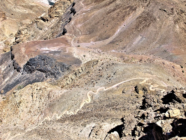
[Fish River Canyon] Beginning of a five-day trek through the canyon, I really could not do it by bike
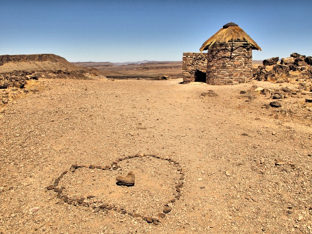
[Fish River Canyon] In front, a romantic love declaration, behind it, a toilet – in case the over-abundance of love causes any digestive problems...
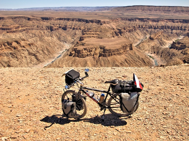
[Fish River Canyon] I dare not go closer to the edge of the canyon with the bike, it is a sheer drop
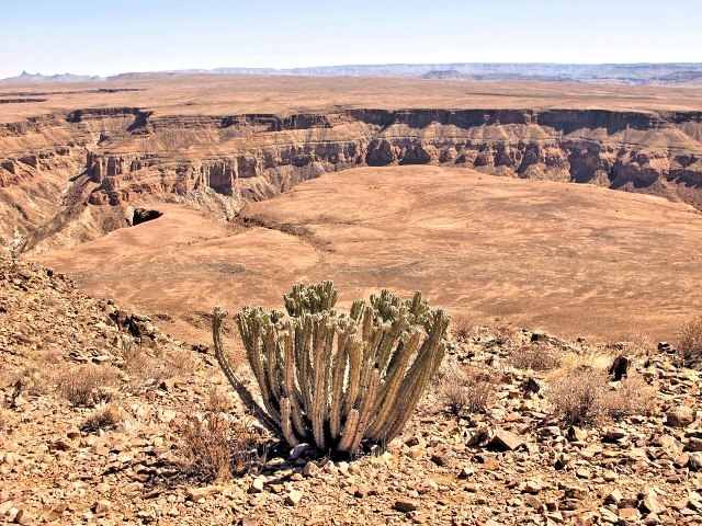
[Fish River Canyon] Cacti grow even in such an inhospitable landscape
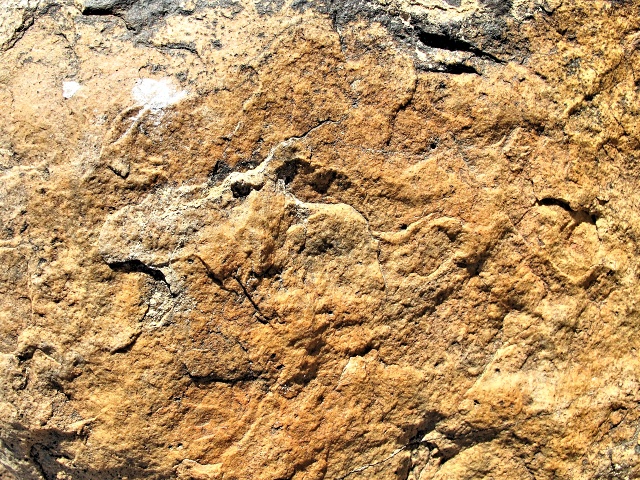
[Fish River Canyon] World-famous 12,000-year-old rock engraving of a fleeing hare, found in Apollo 11 cave
The previous “engraving” is the photo of the surface of a stone resembling an animal. This small joke is no precious artifact. But the Apollo 11 cave exists (it was discovered during the Apollo 11 moon landing in 1969). In the cave, a series of paintings were found, as well as unique portable boards with paintings of animals that had been used by shamans as instruments in ceremonies.
Hobas
I cycled back to Hobas and had originally intended to go to three lodges, situated about 12 km away. To make sure, I asked if they also had a campsite. There were none at any of those lodges, so I stayed in Hobas because there was only another camp at Ai-Ais, 70 km away. I had no reason to rush, as I had to leave Namibia by September 30 and would manage this without a problem. By the way, what I was told in the Caňon Roadhouse was not true: if you stay in the campsite, you do not have to pay an entrance fee to the National Park.
The camp was perfect, because there were tables and chairs. I could move the table to the wall plug and write my blog while charging the battery of the laptop. I left my bags on the bike, did not put them in the tent so I had plenty of space. During the night it seemed to me that somebody was messing about with the bike and moving the bags around, but I always just fell asleep again. In the morning, it transpired that there had been baboons who had felt my dwindling supplies and wanted to get into the bags. Fortunately, they had failed to do so. They do not have sufficiently skilled front legs (actually hands). It was fun – I cooked breakfast in the morning, the monkeys ran around me, climbed into the trash cans, at times standing up on their hind legs to see what I was cooking for breakfast.
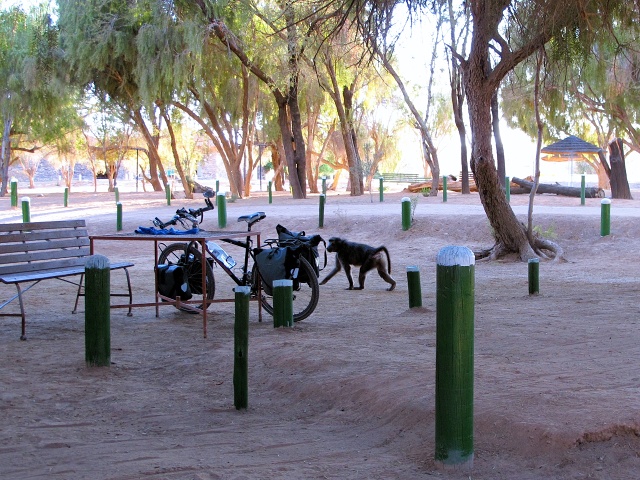
[Hobas] Baboons scurry around my bike and tent at cockcrow

[Hobas] Baboon
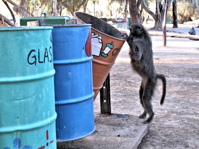
[Hobas] Baboon inspects the trash drums
The route to Ai-Ais was relatively easy. The first 20 km were on a bad road covered in sand. But as is usual there, the road was only bad in a few sections, typically buried in sand at the lowest point, dead center before a climb. Worse was the fact that in the intensity of local daylight the details blend together and so I never knew exactly where the sand drifts would be. And so the Scout saying: “Be Prepared” applied. I sat towards the rear of the bike to reduce the weight on the front wheel and cope with the pitfalls of the terrain. The road improved, but began to rise steadily again. With the support of fresh air from behind, that was not a problem. The second half of the road steadily descended and, although cycling against the wind for a change, I had to apply the brakes often anyway, due to the bad road.

[20 km south of Hobas] The road leads on to a mountain plateau

[25 km south of Hobas] A lizard (leguaan), over a meter long, promenades along the road
Ai-Ais
An oasis for tourists was built at the bottom of the canyon. It is managed by the State NWR and so, after the experience at Sesriem, I expected a nasty camp. The opposite was true. There are freely movable benches in the camp, as well as several camping kitchens with stoves, clothes hangers—just a perfect campsite. I paid for two nights – I did the laundry, washed the bike and bags, greased the chain and pedals, made minor repairs and adjustments. The following day, I undertook a half-day walking trek through the canyon, where I saw several Kudu and lots of baboons. In the evening I relaxed in the warm pool of the spa. And I took some beer medicine with the first cyclist I had met in Namibia. He was a young man from South Africa, now doing his Master's degree in Macrobiology and on his first cycling trip. He carried no bags, but a trailer, and he was carrying a stunning 40-kg load – including a heavy rack for fixing the bike during assembly, which weighed more than 1 kg, a small camping chair, in addition to a tent, also a canopy for protection against the wind, several books and similar paraphernalia. That is why he only did about 50 km per day, but allegedly because he wanted to get to know the people. I did not know where he was going to find them in the barren landscape. So I gave him some of my wisdom, about what he would and would not need, and in exchange he talked about South Africa.

[Ai-Ais] Camp with spa building on the left
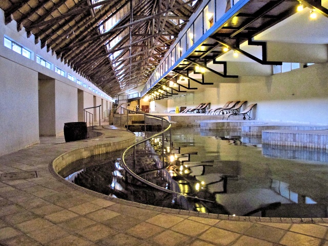
[Ai-Ais] Spa pool with hot mineral water

[Ai-Ais] Fish River Canyon
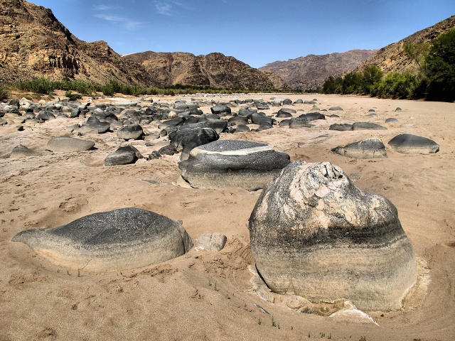
[Ai-Ais] Fish River Canyon – water in the river often disappears for hundreds of meters
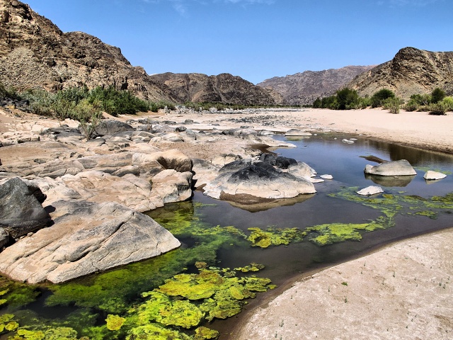
[Ai-Ais] Fish River Canyon – the Fish River forms lonely pools
A 15-dollar Baboon
As in Hobas, also here baboons carried out raids on the camp in the morning, raking through the trash, rampaging on the balconies of the spa building and similar monkey business. I was just having my breakfast at the table in the camp kitchen and watching them in amused detachment while finishing the local coffee (a blend of coffee and chicory). Suddenly Colin yelled at me: "Jiri, watch out!" I turned and saw a baboon sailing through the air to the table. He landed, and grabbed a loaf of bread which was in a plastic bag. I resourcefully seized the bag, but the bag tore and the monkey ran off with the bread. Choke on it, you monkey! Luckily I managed to buy a new loaf for 15 Namibian bucks, but it took me 20 minutes to find the restaurant staff to sell it to me.
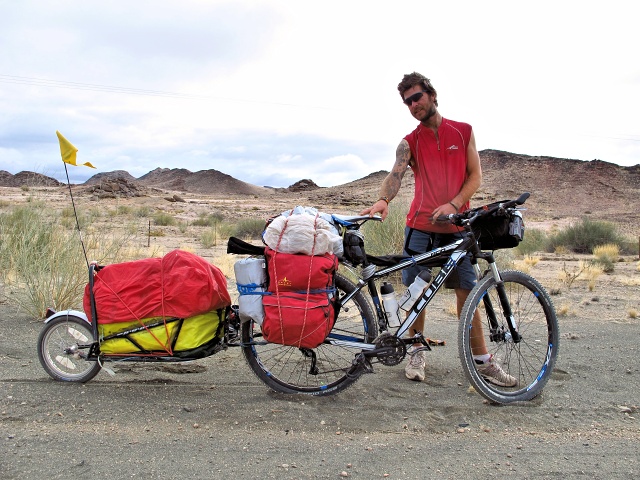
[9 km from Ai-Ais] First cyclist I meet in Namibia – Colin Walsh on the first cycle tour of his life

[9 km from Ai-Ais] Colin is proud of his tattoos
Colin left three-quarters of an hour before me, but after 9 km of continuous climb, I caught up with him. Once more, I complimented him on his tattoos of which he was so proud, took a photo of his heavily laden machine and waved at him for the last time from the top of the climb. He was going to Hobas, it was uphill, but with the wind at his back, and I turned to the south at the crossroads and got the wind right in my face. The weather deteriorated, it even rained so hard for 10 minutes that I started to pull out my Gore-Tex jacket. But the wind was still strong and cold, so for the first time I wore the softshell jacket the whole way.

[15 km from Ai-Ais] Bad road, and it even rained heavily for 10 minutes
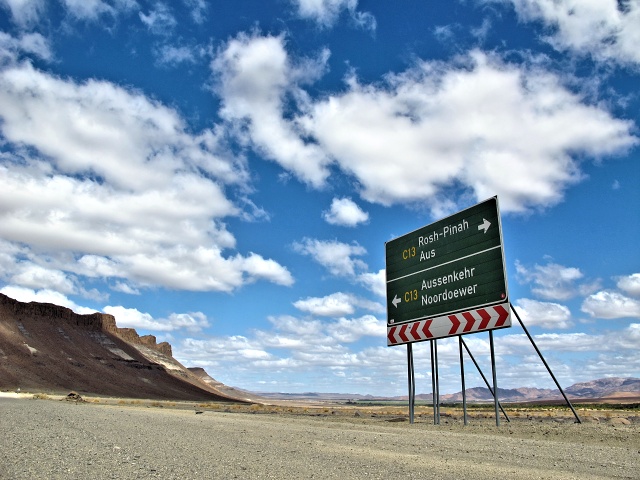
[Intersection before Aussenkehr] Easy route to South Africa on the left; I take the one on the right

[Near Aussenkehr] Picturesque rocks embedded in the sand
Aussenkehr
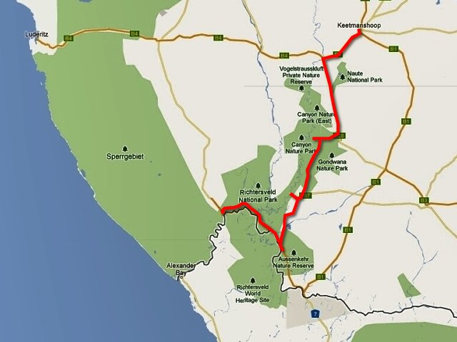
The town of Aussenkehr is situated on the Orange River and I had two options at the nearby intersection. Either to go left into the town and then continue on to Noordoewer and on the paved road to Springbok in South Africa. Or to turn right and go along the Orange River to the border crossing at Sendelingsdrift, where South Africa is entered across the river on a pontoon. I chose a combination. I cycled to Aussenkehr and was surprised that it is a large town of thatched huts. The Orange River is a blessing to its surroundings, with the desert suddenly becoming a lush, green and fertile country. Mostly grapes and fruit are grown in the area, therefore laborers are needed. Workers and their families live in the thatched huts, which is very good housing under local conditions, but, measured by our standards, it is grinding poverty. A shack tacked together from corrugated iron – a Shebeen, the local pub, occasionally peeped out from among the huts. There illegally – without a license – but quite publicly, alcohol is served. The Police ignores them, they do not want to go into the townships. In addition, a closed pub would be immediately replaced by another.
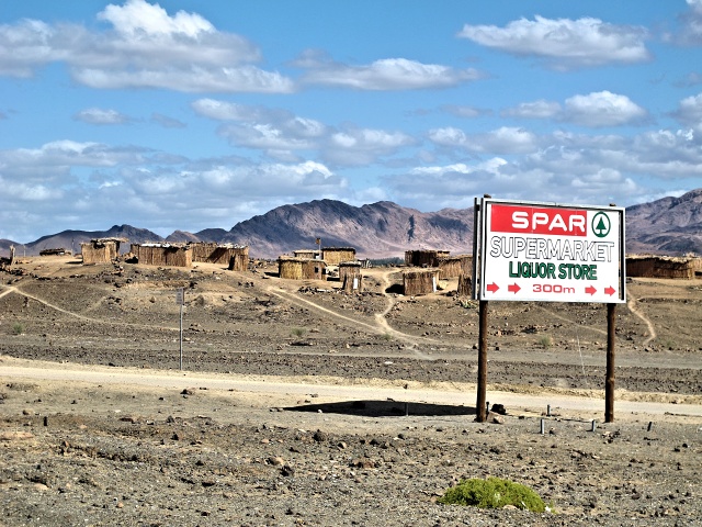
[Aussenkehr] The whole settlement consists of straw huts
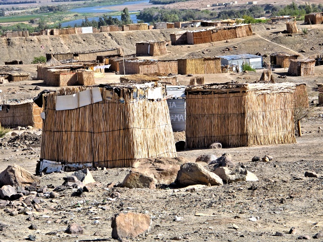
[Aussenkehr] The pubs are made of corrugated iron; liquor sales are profitable everywhere
I was able to replenish my stocks at the local SPAR, and then go on to the campsite, 10 km away at Norotshama Lodge. A very luxurious place, the first time I could get a WiFi connection in a tent! In the morning, I returned, passed Aussenkehr and hit a small road along the river.
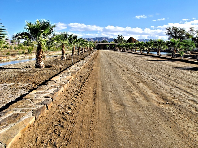
[10 km east of Aussenkehr] Arrival at Norotshama Lodge – a strong contrast to the Aussenkehr shacks
The journey was picturesque, the surrounding mountains impressive. The road was more or less straight, although bad enough. A saddle with an elevation of roughly 400 meters had to be surmounted in only 14 km and part of the road was excavated through rock. I enjoyed crossing the Fish River, which extricated itself from the canyon to merge with the Orange River and, after several kilometers, with the Atlantic Ocean. Near the border crossing, the river was particularly impressive, big boulders and rocks protruding from the water, as well as lush green reeds and all this surrounded by the mountains peeping out from the Richtersveld National Park in South Africa.

[Near the intersection of Aussenkehr] The road along the Orange River surrounded by mountains

[15 km before the mouth of the Fish River] The road is cut through the rock; the climb up the mountain pass is very steep
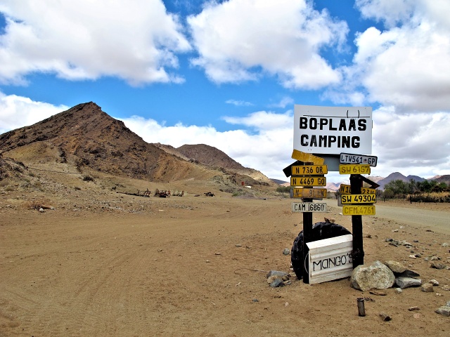
[5 km before the mouth of the Fish River] The only campsite on the way to the border

[Fish River Crossing] The Fish River finally breaks through the canyon, flowing into the Orange River
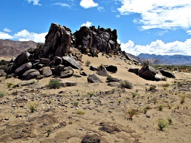
[25 km before the border] The picturesque surroundings along the road
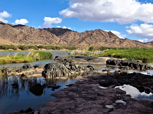
[20 km before the border] Rocks protrude in the Orange River
Leaving Namibia
There was a campsite in the middle of the route, but I skipped that one. According to the map, a camp should be located right at the border crossing, so I did not even take any water with me. However, there was no camp. More precisely, it was on the other side of the river, in South Africa. The border crossing, however, closes at 16:30 and I was there later than that. So I filled a full 10-liter bag of water at one little house and went back several kilometers to a pre-selected spot above the river, where I slept out in the wilds. In the morning, I took some water again to be sure, this time only about 5 liters, and went to check at the Immigration post. There again, they studied my passport and instructions for a long time on their computer, shaking their heads. I wondered what those scamps from the Berlin Embassy actually wrote there in revenge for the fact that I had dared to enquire about the visa one month after the application. Finally, they stamped the passport and asked me to hand over the forgotten bungalow keys to the pontoon crew. Then I cycled to the river and waited for about half an hour before the pontoon moored in South Africa came for me. Transport was free and 10 minutes later I was in South Africa.
I was really excited to see what awaited me. Before my departure from the Czech Republic, many people had warned me against going to South Africa, even people born in South Africa who have relocated to Europe. Almost all referred to the fact that in South Africa people are killed for trifles such as a cellphone. So I reassured them by saying that I do not carry a cellphone while travelling. Also in Namibia the local people often told me that I should not cycle in South Africa, that a car would knock me off the road, they would rob me of everything, and if I was lucky, they would leave me lying wounded in a ditch and would not kill me. I felt a little bit uneasy about this, but I drew hope from an interview with a biker from Pretoria, whom I had met in Betta. I asked about the situation in his homeland, and whether I could travel by bike there. "Sure," he said, "you can cycle through the country, but you must not give those bastards a chance." I was determined not to give it to them.
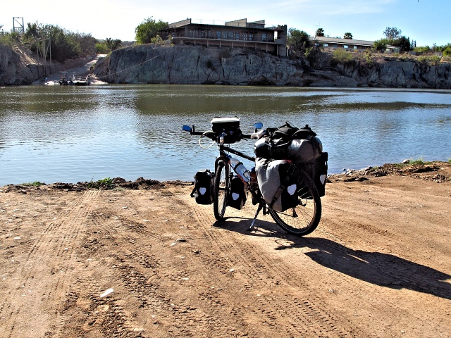
[Sendelingsdrift] The last photo of Namibia – waiting for transport to South Africa


| 


